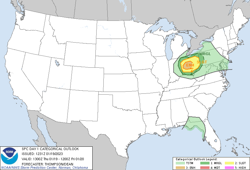
A strong low-pressure system that brought widespread snowfall to Denver has moved eastward and onto the plains. Here the low-pressure system has ramped up in strength as it continues to impact areas from the Midwest southward along the Mississippi river valley. As this system progresses, an enhanced chance for severe weather, including tornadoes, will impact areas along the Ohio Valley as seen in the image here:
Currently a few scattered rain showers are in this area and will move out through the rest of the morning leading to mostly sunny skies this afternoon before another round of rain showers/thunderstorms moves into this area. Best timing will be between 2-6 pm today with the severity of storms decreasing after sundown. With this round of storms, expect isolated heavy rainfall, strong winds 60+mph gusts, hail up to 2″ with an isolated tornadoes possible as well.