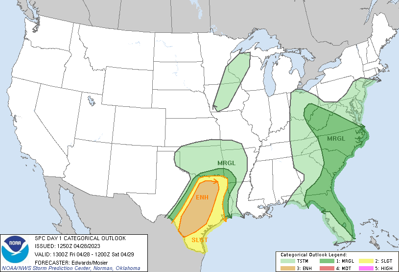
After a round of rain and snow for Colorado, this storm system will continue eastward brigning a decent chance for severe weather across portions of Texas. Best chance for storms will be along eastern portions of the state, including the DFW area and southward into Houston. The strongest storms are expected between 2-8pm this afternoon and evening, when daytime heating is at its peak. Biggest threat today will be gusty winds 60+mph, heavy rainfall leading to localized flooding, hail up to 3″ under stronger developed storms. An isolated tornado or two also cannot be ruled out, generally in the EF0-EF2 range. Storms will likely be linear in nature, resulting in a greater chance for strong straight lined winds, however a few embedded supercells could be possible, which will be the culprit for any tornadic activity. Below is the Concevtive Outlood for today provided by the National Weather Services’s Storm Prediction Center: