An active start to the severe weather season so far will continue into this weekend with another good chance for severe weather for several locations. Once again, the strongest storms will likely hold off until the later afternoon and into the evening Saturday, March 31st. The largest threat with these storms will be heavy rainfall, strong winds 60+mph and hail up to 3”. Also, a good chance for isolated tornadoes, with some tornadoes becoming very strong with the potential for long lasting storm tracks. Areas of biggest concern are highlighted below:
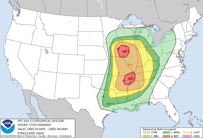
Based on the map provided by the National Weather Service’s Storm Prediction Center, the highest chance for severe weather will be along the Iowa/Illinois border and the Arkansas/Kentucky/Tennessee/Mississippi area. I would expect to see opportunities for severe weather across major portions of these areas, with a higher likelihood of tornadic activity further south around Dixie Alley, rather than northward at this time. This is mainly due to better upper-level support along southern portions of this storm system. Storm intensities should diminish through the overnight hours with chances for severe weather continuing eastward through Sunday.