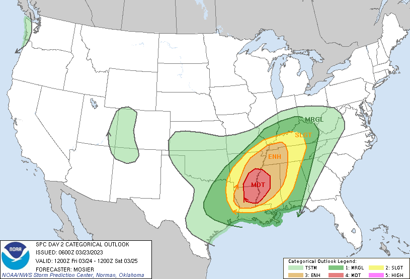
There will be an active afternoon and evening for the Texas/Oklahoma area as a cold front moves through the region throughout the day today. This will bring a slight chance for some severe weather late this afternoon and into the evening for Texas, then likely impacting Dallas throughout most of the day Friday. As this cold front progresses eastward and into the Dixie Alley region, it will bring an explosive weather in the late evening Friday, March 24th, 2023 through the overnight and into Saturday, March, 25th, 2023. Generally, storms will remain linear, resulting multiple lines of thunderstorms from the Arkansas region and southward into Louisiana. The biggest threat with these linear storms will be strong straight-line winds with gusts 60+mph, hail up to 2.0”, heavy rainfall leading to localized flash flooding. However, with enhanced upper-level support, a few embedded supercells cannot be completely ruled out within these linear system bringing a good chance for isolated tornadic activity with some of these tornadoes to be strong enough for the EF2-EF3 range, which could potentially impact structures during this event. Another big area of concern will be timing of these storms with the best chance for the strongest storms late Friday evening, through the overnight and into daybreak Saturday. These overnight storms will make seeing any severe weather, especially any tornadic activity, very difficult and people will likely need to be on alert during this time. Above is a map provided by the National Weather Service’s Storm Prediction Center detailing the area that will be most impacted during this event. As the day continues Saturday, more weather is expected to move eastward and towards the Atlantic, however the severity of storms will decrease significantly Saturday into Sunday.