A trough of low-pressure will scurry across the Pacific northwest today bringing a good chance for widespread severe weather for eastern portions of Washington state, northern Idaho, northeastern Oregon, and far western Montana. The area of concern is under a slight chance for severe weather per the National Weather Service’s Storm Prediction Center and featured here:
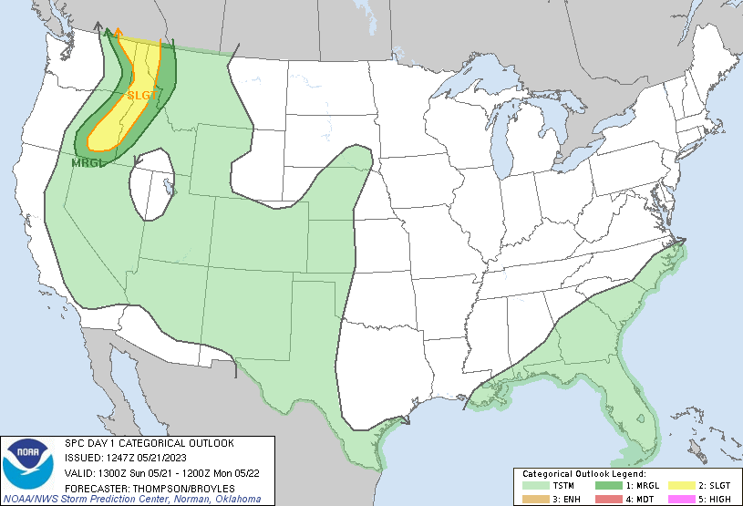
In the area of concern, expect to see widespread thunderstorm activity with a good chance some of the storms will become severe this afternoon and evening. The best time for storms will coincide with peak daytime heating, between 2-8pm with lingering thunderstorms likely into the overnight hours. With these storms, expect to see heavy rainfall with isolated localized flash flooding. Strong, gusty winds over 60mph under and ahead of storms. Hail up to 1.25″ or roughly half dollar size and storm will also contain frequent cloud to ground lightning. Severe weather chances subside in this area tomorrow, with only a slight chance for general rain showers/isolated thunderstorms tomorrow afternoon and early evening.