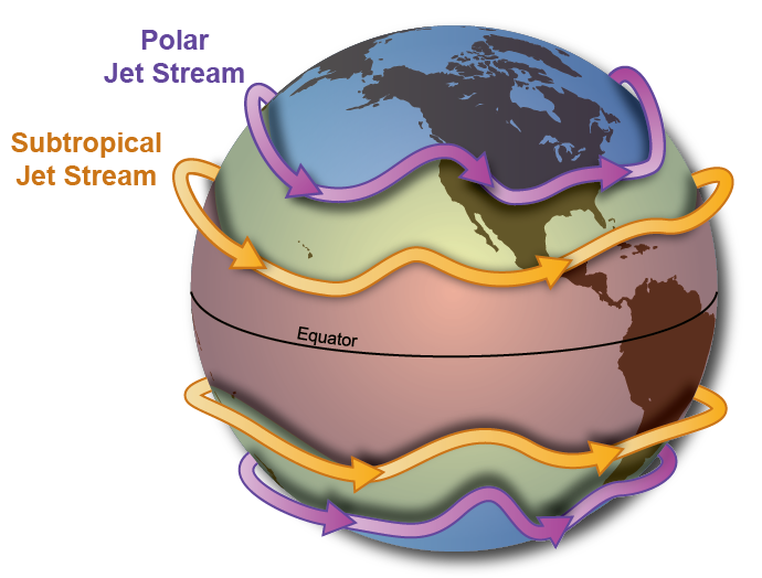
What is the Jet Stream?
The jet stream is a high-altitude air current that flows from west to east and is caused by the uneven heating and rotation of the Earth. It separates synoptic-scale warm airmasses from cold airmasses and can transport weather systems across the United States, affecting temperature and precipitation. The jet stream is strongest over areas with narrow surface temperature gradients (where there is the largest change in temperature over distance). Regions of the jet stream where winds are strongest are called jet streaks. Jet streaks are responsible for the movement and location of storm systems, which can be thousands of miles across and affect more than half of the U.S at a given time.
In the summer months, the jet stream weakens as the Arctic warms and the temperature gradient widens. As a result, jet stream winds weaken and are gradually pushed north into Canada throughout the duration of the spring and early summer. In the absence of a strong jet stream, daytime heating is the primary atmospheric force in summer. Warm moist air becomes unstable throughout the day due to surface heating, initiating afternoon and evening thunderstorms. As the sun sets, daytime heat is lost, and thunderstorms typically begin to subside overnight, only to redevelop the next day.
During the winter, the jet stream can migrate south, steering winter storms across the Intermountain West. If the jet stream remains north of Colorado, the weather pattern will be more tranquil. If the jet stream digs further south, the winter weather pattern will become more active as early as November and December. Understanding the jet stream and its effects on weather patterns is important for meteorologists and anyone interested in the science of the atmosphere.