About Skyview Weather
Company Background and Information
Skyview Weather has been the leading provider for weather operations and custom forecasts across the Intermountain West since the late 70s. During this time, Skyview Weather has become known for its accurate forecasts, prompt operational services, attention to detail, and expert winter, severe, and flood response and analysis.
Meet The Team
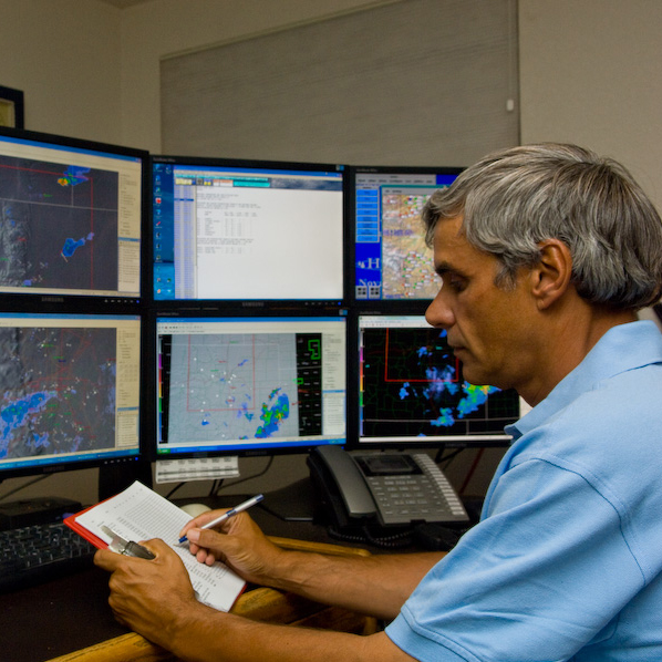
Timothy Tonge
President
Mr. Tonge has worked with Skyview Weather since 1994. He graduated from the University of Colorado with a B.S. in Business in 1979, with additional class work in meteorology. Upon his joining Skyview Weather, he was mentored by Meteorologist Paul Potter and has subsequently taken additional meteorology and wildland fire classes. Mr. Tonge has forecasted on daily basis for over fifteen years, and provided operational support to a variety of clients during this time. Mr. Tonge’s affiliation with the Castle Rock Fire Department has given him many years of experience in wildland fire behavior, HAZMAT incidents, and other emergency situations where spot weather and accurate forecasts are critical. He has developed a program of weather support for not only fire departments but also city and county emergency management. Mr. Tonge is also active with the National Weather Service’s Skywarn Program and has been an instructor for spotters for almost twenty years.
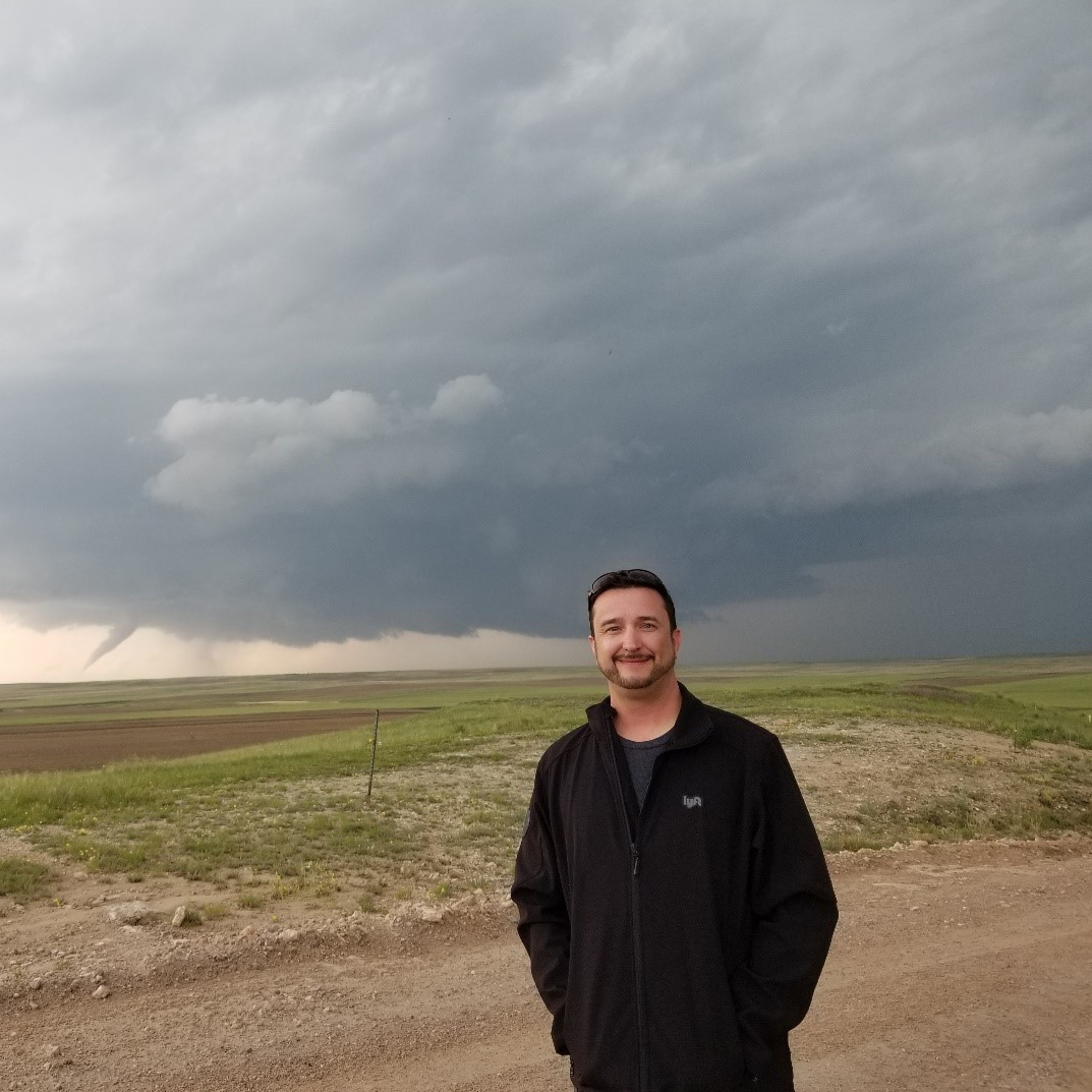
Justin Brooks
Lead Meteorologist
Justin has grown up in the Denver area and is very passionate about the weather and loves to watch how it unfolds across the Denver Metro Area as well as out on the eastern plains. He is specifically in tuned to severe weather including tornadoes, large hail, flooding and lightning. Justin has several years of experience both as an amateur and research storm chaser with several chase excursions involving the Center for Severe Weather Research (CSWR) based in Boulder, Colorado. A graduate of Metropolitan State University of Denver in 2015 with a B.S. in Meteorology with a focus in research, weather radar and instrumentation, he has been working with Skyview Weather since that time. At Skyview Weather he has enhanced his skills in forecasting, current weather observations and effective communication during weather events, specifically in lightning detection and severe weather across the country. When he’s not in front of a computer keeping an eye on the weather, Justin enjoys spending time in the outdoors to enjoy the beautiful Colorado landscape.
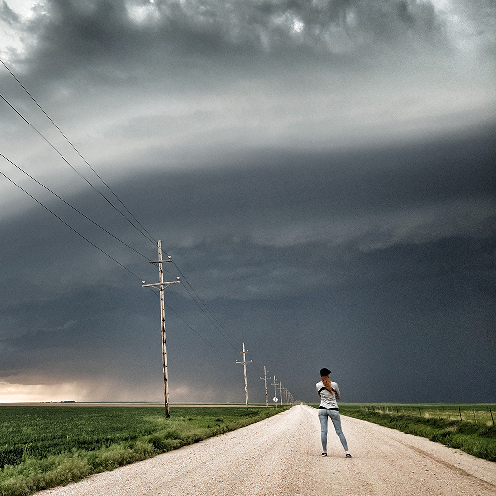
Laura Smith
Meteorologist
At the age of five, Laura experienced the environmental disaster of Hurricane Andrew as it made landfall over the Florida peninsula. Today, the memory of this catastrophic storm continues to inspire her curiosity and boundless passion for weather. Although she grew up on the warm beaches of Florida, Laura dreamed of a place with snow and exciting weather. She moved to Colorado in 2014 to attend the Metropolitan State University of Denver Meteorology program. While completing her undergraduate studies, Laura participated in several research projects focused on weather phenomena unique to the Colorado territory such as complex terrain thunderstorms, wild fires, and the Denver Convergence-Vorticity Zone. She spent summer breaks storm chasing in Eastern Colorado, and winter breaks hiking and snow shoeing across the Rockies. Laura graduated in May of 2021 with a B.S. in Meteorology and a double-minor in Math and Computer Science. She joined the Skyview Weather team the day after her last final exam!
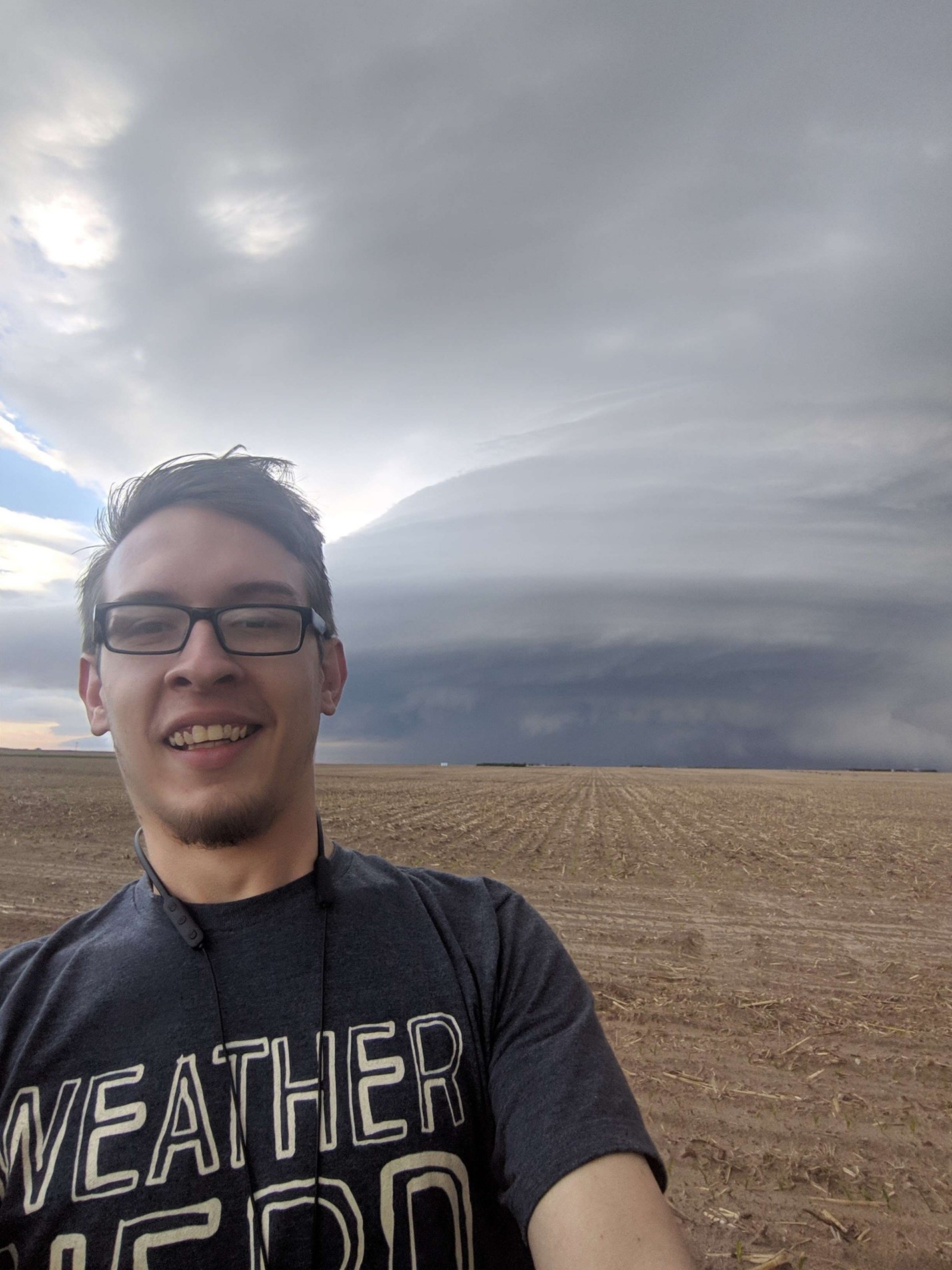
Aaron O’Brien
Meteorologist
Aaron O’Brien’s fascination with weather began at an early age, fueled by countless hours watching The Weather Channel on television. His passion for meteorology grew as he delved into documentaries and dramatic shows, captivated by the intricate dance of atmospheric phenomena. Driven by this lifelong interest, Aaron embarked on a deliberate path toward a career in meteorology. After graduating from a K-12 Charter College Prep school in 2017, he wasted no time and enrolled in the Metropolitan State University of Denver’s esteemed Meteorology program. Throughout his college journey, Aaron actively engaged in extracurricular activities and research projects, each contributing to his depth of knowledge and practical experience. Some highlights from Aaron’s meteorological journey include research projects involving Progressive Derecho Climatology and Plowable Hail Events. Aaron is also a talented expert storm chaser. Aaron’s dedication extended beyond the classroom. He served as a Learning Assistant and Teaching Assistant, guiding fellow students through the intricacies of meteorology coursework. His patient mentoring and commitment to fostering understanding left a lasting impact on aspiring meteorologists. In December 2021, Aaron proudly graduated with a Bachelor of Science in Meteorology, complemented by a minor in mathematics. His academic achievements were underscored by his participation in the prestigious Weather Challenge—an annual nationwide competition where college students, alumni, and weather enthusiasts showcase their forecasting prowess. Aaron’s meteorological acumen propelled him to the top 32 in the country, solidifying his reputation as a skilled forecaster. In January 2023, he joined Skyview Weather, where his expertise and passion found a professional home. As a meteorologist, Aaron continues to unravel the mysteries of the atmosphere, providing accurate forecasts and contributing to our understanding of the ever-changing weather patterns.
Our team of meteorologists bring over 50-years of combined weather forecasting experience to the table. Tap into Skyview Weather’s expertise for reliable and accurate weather information.
What is a Private Weather Forecast Service and how is it different?
In the simplest of terms, a private weather forecast service supplies highly localized weather information and services, such as forecasts and operations, to individual clients based on the specific needs of each client. The National Weather Service (NWS) is a government agency that gathers weather data for generalized forecasts to the public at large. Private weather services like Skyview Weather supply highly detailed, customized weather forecasts and operational support for businesses and organizations whose needs exceed basic weather data provided by the NWS.
Who is Skyview Weather?
The Skyview Weather team is comprised of local meteorologists who enjoy – no, are obsessed with weather! Every meteorologist at Skyview Weather has dedicated years to understanding the complexities of weather unique to the mountains and Great Plains. The passion and experience of the Skyview Team is reflected in both our services and reputation in Colorado and other states across the intermountain west.
Skyview Weather provides a tailored forecast with clients in mind.
Many private and public organizations require a more accurate and sophisticated service than what is typically found on TV, social media, or at the NWS. Skyview Weather fills the void by supplying clients with expert winter weather analysis, snow forecasting, and other details including winter storm timing and duration, snowfall accumulation, snowfall rates, road conditions, and more. Our summer forecasts and real-time monitoring and operational services quickly provide clients with the information necessary to make critical safety decisions such as precise storm location, storm movement, and live lightning strike information. Call us today at 720-443-0895 or email the Skyview Weather team at Forecast@SkyviewWeather.us, so we can develop a comprehensive plan for your operational and forecasting needs.

Severe Weather Updates
National Weather Service text products are received via satellite, allowing us to have instant notification of any NWS watch and/or warning information which we will pass along to you via pager, cell phone, phone call or any other means of communication.

Winter Weather Support
Designed specifically for snow removal, snow plowing operations and key decision makers with regard to winter weather events, our 5-day planning forecasts are issued daily during the morning and updated as needed during the mid to late afternoon so that overnight and next day operations can be planned for.