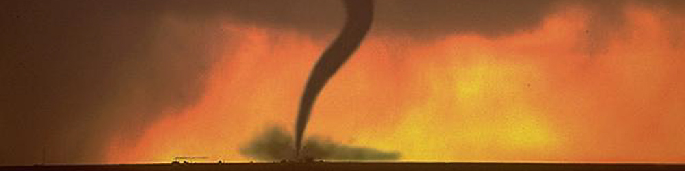
Tornado Season
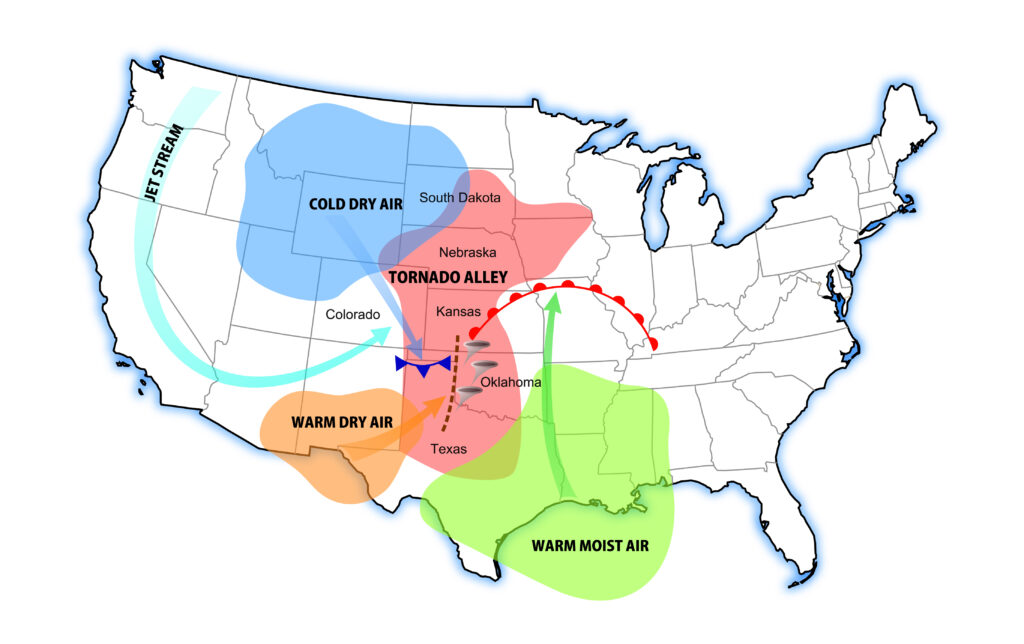
Tornado Alley
Tornadoes are a common occurrence in many parts of the United States, particularly in the region known as “Tornado Alley,” which includes eastern Colorado. While tornadoes can occur at any time of day, they are more frequent in the afternoon and evening, when the heat of the day has produced the hot air that powers a “tornadic thunderstorm”. Tornadoes are most common in the United States, but they also occur in other parts of the world, including India and Bangladesh.
The formation of tornadoes in Tornado Alley is influenced by the Rocky Mountains to the west and the Gulf of Mexico to the south. In the spring, a strong westerly jet stream flows across the Alley, creating instability and a trough of low pressure that draws in warm, moist air from the Gulf. This combination of conditions creates the energy source needed for the development of large, powerful, thunderstorms. This energy source, known as latent heat, is heat energy that is released when water vapor condenses into liquid water.
Wind Shear
While only three ingredients are needed for general thunderstorm development (moisture, instability, lift), tornado formation requires the addition of a fourth ingredient: wind shear. Wind shear refers to changes in wind speed and direction with height in the atmosphere. Wind shear is responsible for the rotation and longevity of thunderstorms, both of which are requirements for tornadic activity. A rotating thunderstorm is called a supercell. Supercell thunderstorms can produce large hail, damaging winds, and tornadoes.
Supercell Thunderstorms and Tornadoes
A tornadic thunderstorm can form when warm, moist air gets trapped beneath a stable layer of cold, dry air, creating a temperature inversion. If this cap is disturbed by a front or movement in the upper atmosphere, the warm, moist air can punch through the stable layer. Once the cap is broken, water vapor in the updraft quickly condenses, releasing latent heat energy into the near storm environment. At the same time, wind shear tilts and twists the updraft. This rotating updraft, known as a mesocyclone, can gain velocity with the help of different winds at different levels of the atmosphere.
A fully realized supercell can develop in 45-60 minutes once convection has been initiated. Although these special thunderstorms are powerful and rotate, most supercells do not produce a tornado. Additional factors can inhibit tornado development in a supercell such as topography, weak low level winds, dry air entrainment, cloud cover ahead of the storm, and many others.
Land Spout Tornadoes
Although large supercell tornadoes are infrequent across Colorado, the land spout tornado is quite common. Land spouts are smaller, brief tornadoes which form along a surface level wind convergence area. Areas of convergence are a common occurrence across the High Plains and even in large Colorado valleys. Most notable is the recurring Denver Convergence Vorticity Zone (DCVZ), located just east of Denver. The DCVZ is responsible for numerous tornado outbreaks across the Front Range Urban Corridor and has even produced tornadoes on the tarmac at Denver International Airport. Land spout tornadoes are less powerful than supercell tornadoes and may only last a few minutes. However, these tornadoes have a history of reaching EF1 and EF2 intensity, which can cause serious harm to people and property.
Conclusion
In summary, the formation of tornadoes involves a complex combination of factors, including moisture, instability, lift, and wind shear. Understanding tornadoes is crucial for several reasons:
Safety and Preparedness: Tornadoes are among the most violent natural atmospheric phenomena. Learning about them helps us prepare for their occurrence. By understanding tornado formation, behavior, and warning processes, we can take necessary precautions to minimize the risk of death and injury.
Mitigating Damage: Knowledge about tornadoes allows us to take preventive measures. Understanding their strength and impact helps communities build resilient structures, secure belongings, and develop emergency plans. This proactive approach can significantly reduce property damage and save lives.
Early Warning Systems: Learning about tornadoes contributes to the effectiveness of early warning systems. Meteorologists monitor weather conditions and issue tornado alerts when conditions are favorable. Being informed empowers individuals to stay alert and take shelter when necessary.
If you liked this article, check out Skyview Weather’s growing library of educational weather and climate content. Skyview Weather also offers comprehensive in-person and virtual weather education and weather safety training classes to ensure you and your staff are informed and prepared for severe, winter, and fire weather.