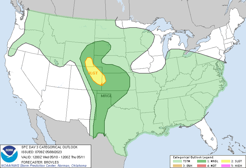
This Wednesday, May 10, 2023, there will be a chance for severe weather, especially areas east of the I-25 corridor as seen in the map provided by the National Weather Service’s Storm Prediction Center. A series of weak disturbances will move across the region today and tomorrow bringing limited rainfall with an isolated weak thunderstorm or two. Wednesday’s dynamics change as good upper-level support moves directly overhead resulting in a chance for strong to severe storms to develop. Daytime temperatures Wednesday should have no problems reaching the low to mid 70’s before storms start to form along the higher terrain foothills by midday with rain showers and thunderstorms moving onto the plains in the afternoon. The best chance for storms for the Denver Metro area will be between 2-8pm with a slight chance for a few nocturnal showers/isolated thunderstorms as good upper-level supports holds through the evening, into the overnight and through daybreak Thursday. The largest threat will likely be hail up to 1.25”, winds 60+ mph and heavy localized rainfall leading to flash flooding. An isolated land spout or weak EFO-EF1 tornado cannot be completely ruled out, likely areas well east of the Denver Metro (DIA and eastward onto the eastern plains). Storm intensity should diminish quickly after dark; however, a few isolated overnight thunderstorms will be possible, mainly for areas out on the eastern plains, but could extend westward and along the I-25 corridor as gusts fronts move back into the region during the late evening hours.