A Pacific Atmospheric River (AR) will channel impressive amounts of moisture into the Intermountain West as a strong upper-level disturbance works its way south across the Rockies.
The GOES-West visible satellite loop below shows a ribbon of oceanic moisture streaming into the Pacific Northwest. A high-pressure ridge, rotating clockwise from the California coast and Baja peninsula to as far west as Hawaii, is the steering mechanism for the AR. This ridge will begin drifting south over the next 24 hours, directing the AR towards the Rockies.
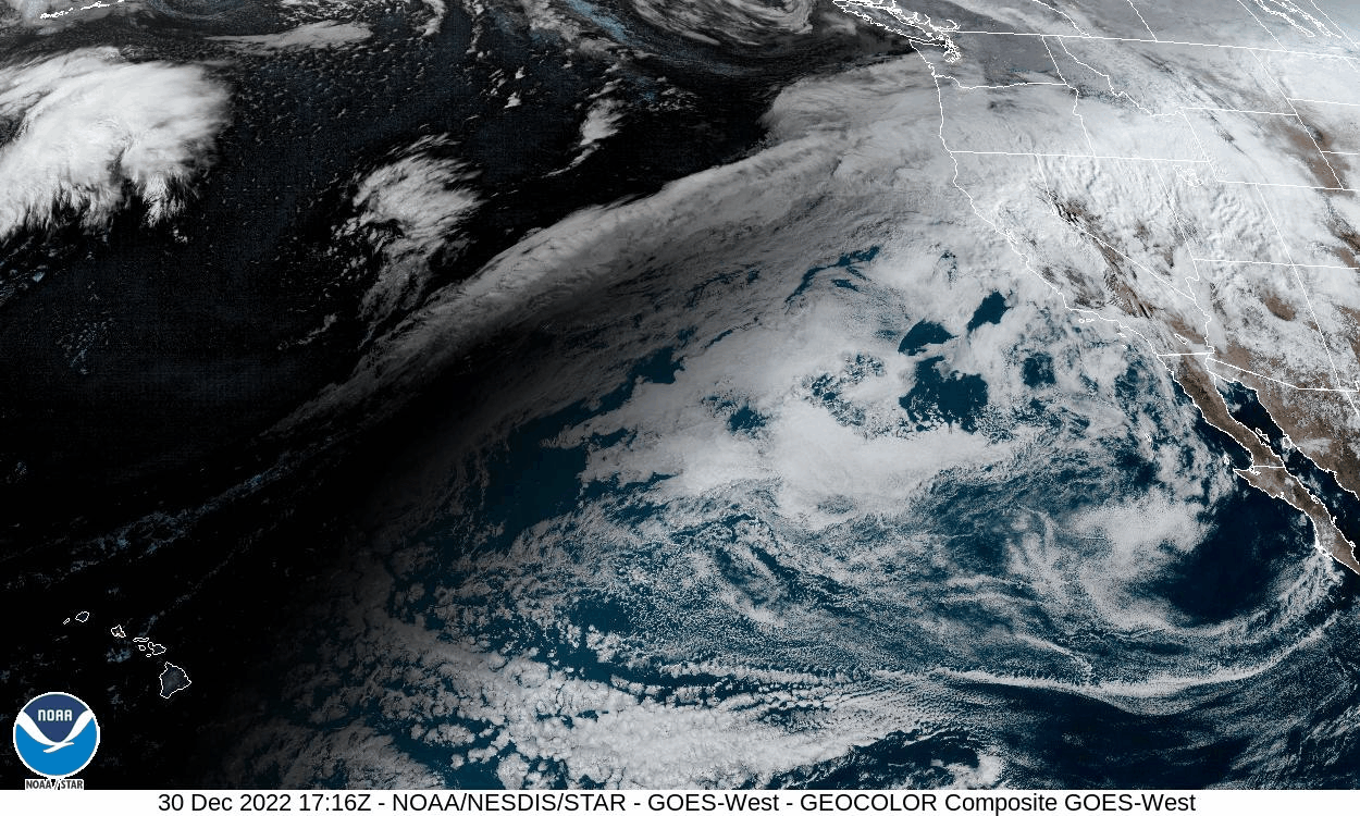
(Borrowed from NOAA GOES Image Viewer)
This winter storm is expected to develop into a negatively tilted closed-low, amplified by a broad and open warm sector. Not only are these closed-low systems notoriously powerful weather machines, they tend to move slowly across mountainous terrain. This pattern, coupled with the AR, supports the development of a significant winter cyclone capable of producing several feet of snow across the four-corners region mountain ranges over the next 24 to 72 hours.
By January 1st, this winter storm will descend onto the high plains, strengthening via lee-cyclogenesis. Widespread winter weather including heavy snow, blowing snow, freezing rain, and sleet is expected across the Great Plains as this system tracks east.