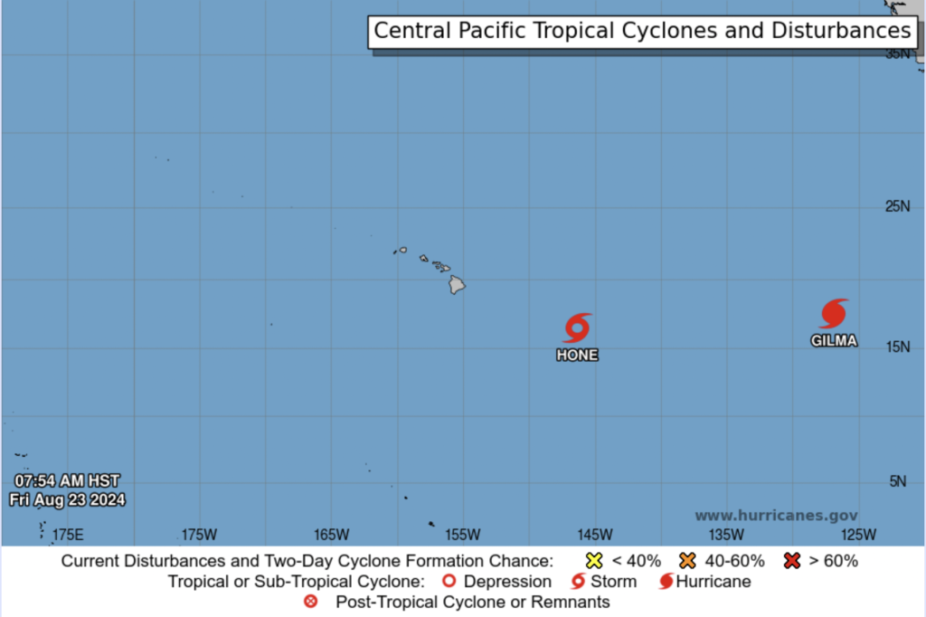
As the Pacific hurricane season intensifies, Hawaii is bracing for potential impacts from two tropical systems: Tropical Storm Hone and Hurricane Gilma. These storms are currently churning in the central and eastern Pacific, posing a dual threat to the islands over the coming days.

Tropical Storm Hone: A Closer Threat
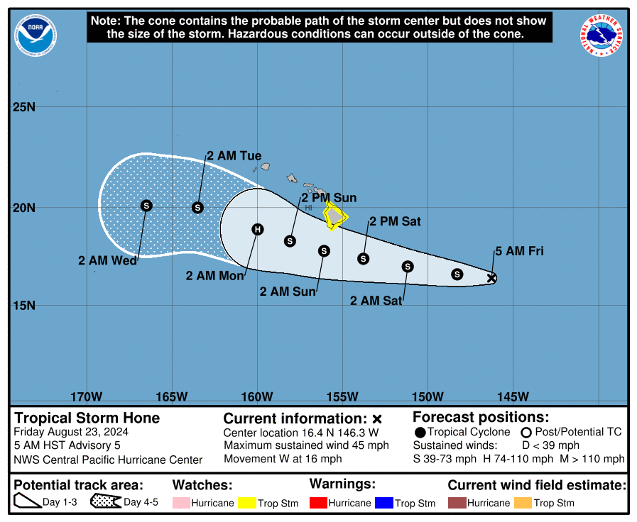
Tropical Storm Hone, located about 500 miles east-southeast of Hilo, Hawaii, is steadily moving toward the islands at a slow pace of 14 mph. As of now the system, is expected to pass south of, or possibly near, the Big Island of Hawaii late Saturday through early Sunday. On its current track, Hone has the potential to bring heavy rainfall, damaging winds, and large surf to the Hawaiian Islands.
Hone Discussion Update:
Hone currently has sustained winds of 40 knots, with limited deep convection near its center. A U.S. Air Force Hurricane Hunter Aircraft is on its way to gather more detailed information about the storm’s intensity and structure. The storm is being steered westward by a large subtropical ridge to the north, with gradual strengthening possible as it moves into an area of slightly warmer sea surface temperatures.
Hone could intensify into a hurricane by Sunday or Monday as it passes south of the Hawaiian Islands, where conditions may be favorable for further development. However, increased vertical wind shear and dry air are expected to cause weakening by midweek. The key threats from Hone include the potential for flash flooding, especially on windward and southeastern slopes of the Big Island, strong tropical storm-force winds, and dangerous surf and rip currents.

Hurricane Gilma: A Powerful System on the Horizon
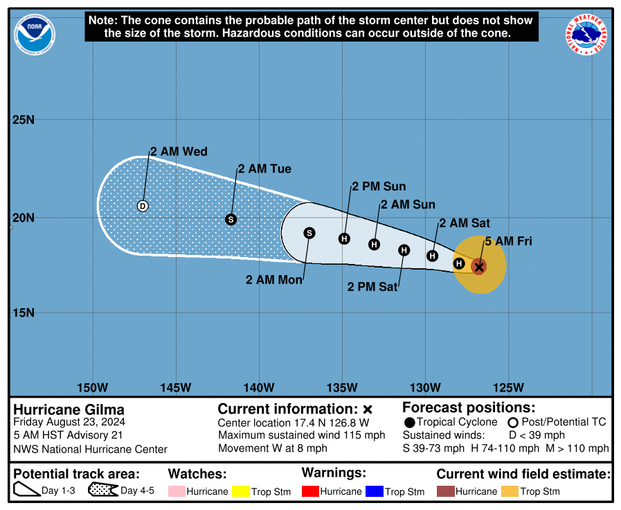
Further to the east, Hurricane Gilma is spinning in the Eastern Pacific, roughly 1,000 miles east of Hilo. The National Hurricane Center (NHC) has downgraded Gilma slightly in strength, now with sustained winds of 100 knots. The storm’s cloud pattern has lost some organization, with the eye becoming less distinct and the central dense overcast becoming more ragged. Despite this, Gilma remains a significant storm that could bring impacts to Hawaii next week.
Gilma Discussion Update:
Gilma is moving westward at 7 knots, steered by a high-pressure ridge expected to build over the eastern North Pacific. The hurricane is gradually heading toward cooler waters and a drier air mass, leading to gradual weakening over the next 60 hours. Gilma is expected to weaken more quickly after encountering stronger wind shear and sea surface temperatures near 25°C. The NHC forecasts Gilma to degenerate into a remnant low within five days.
Though Gilma’s path has shifted slightly to the south, the storm remains on a westward track that could bring it close to the Hawaiian Islands by the middle of next week.

Hawaii’s Vigilance
With Tropical Storm Hone approaching and Hurricane Gilma looming on the horizon, Hawaii finds itself facing a double threat. Tropical storm conditions, heavy rain, and high surf are possible over the weekend, with the heaviest impacts expected on the Big Island.
Residents and visitors alike are urged to stay informed through official channels, including the Central Pacific Hurricane Center and National Weather Service, as forecasts will be refined in the coming days.
Preparedness is key as Hawaii prepares for the potential impacts of two tropical systems in close succession. The islands could face several days of strong winds, heavy rainfall, and hazardous marine conditions as the Pacific hurricane season shows its power.
