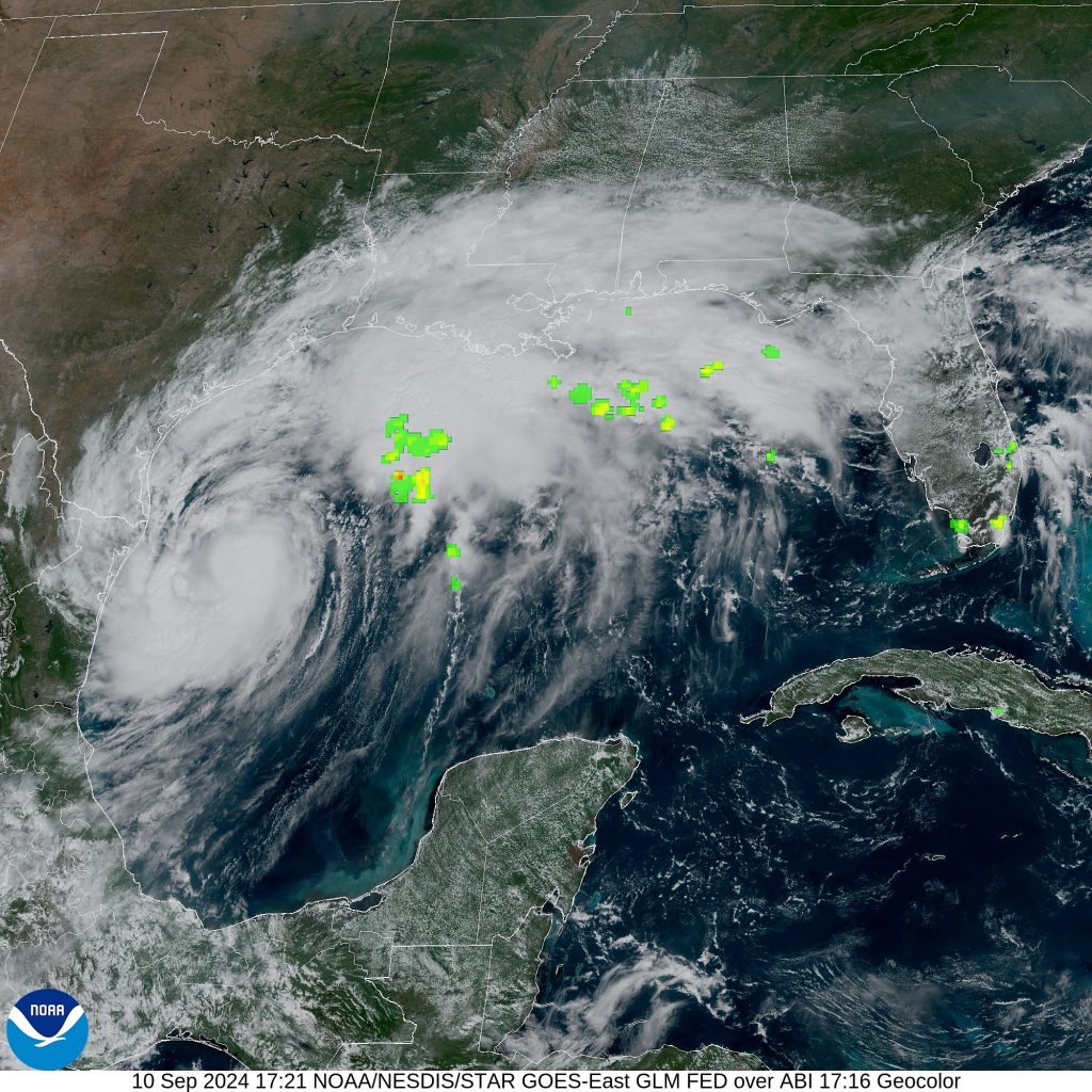
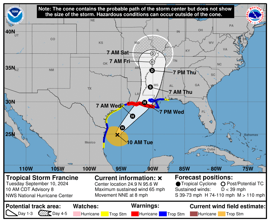
Tropical Storm Francine, currently swirling in the Gulf of Mexico, is expected to make landfall along the Louisiana coast by Wednesday evening, bringing with it a range of tropical hazards. As of the latest advisory, Francine has strengthened, showing signs of organization with a central dense overcast, though maximum sustained winds remain around 55 knots (63 mph). Francine is expected to intensify over the next 24-30 hours before encountering strong wind shear near the coast, which should slow its progress.

Track and Timing
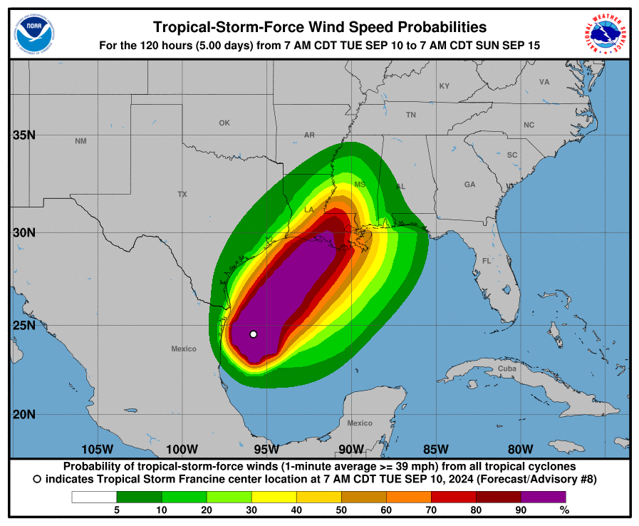
Francine is moving north-northeast at about 8 mph, and the current forecast track shows the storm making landfall near New Iberia, Louisiana. However, there’s been an eastward shift in the storm’s projected path, which could affect the Mississippi and Alabama coastlines. Residents in these areas should remain vigilant as tropical storm watches and warnings have been extended.

Wind and Rainfall Impacts
Francine is forecast to bring hurricane-force winds to parts of southern Louisiana. Winds could reach 85 knots (98 mph) just before landfall, potentially causing significant damage to structures and knocking out power. In addition to the wind threat, Francine is expected to dump between 4-8 inches of rain across the region, with isolated pockets receiving up to 12 inches. Flash flooding, especially in low-lying and urban areas, is a significant concern.

Storm Surge Threat
A storm surge warning is in effect for parts of the Gulf Coast, with the highest risk along the Louisiana coastline west of Port Fourchon, where water levels could rise between 5-10 feet. Areas closer to the Mississippi River could see surges of 2-4 feet. This surge, combined with heavy rainfall, may lead to dangerous flooding in coastal and inland areas.
Tornado Potential
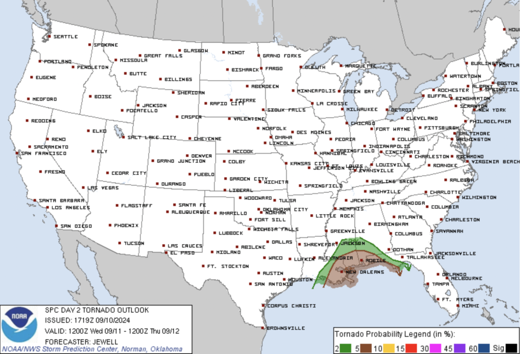
As Francine moves inland, the right front quadrant of the storm—the region most likely to produce tornadoes—will pass over parts of Louisiana, Mississippi, and Alabama. Residents should be prepared for fast-developing tornadoes within the storm’s rain bands, particularly on Wednesday as Francine moves inland.

Preparing for the Storm
While there is still some uncertainty about the storm’s exact track, residents in the Gulf Coast region should finalize their preparations today. Local officials may issue evacuation orders in areas most at risk for storm surge and flash flooding. Even though Francine might weaken after landfall, it will still pose a significant threat in the form of damaging winds, flooding, and tornadoes.
Stay informed, heed any evacuation orders, and prepare to stay indoors as Francine approaches. With improving conditions expected by Thursday, the key now is to stay safe and take necessary precautions until the storm passes. This storm, while concerning, is not expected to linger long after making landfall, and more favorable weather is forecasted for the weekend as Francine’s remnants dissipate.
