On March 23, 2016, a powerful blizzard struck central and northeast Colorado, bringing heavy snowfall, fierce winds, and widespread disruptions. This storm, which intensified as it moved into eastern Colorado, became one of the most significant blizzards to impact the state in recent history.
Storm Development and Meteorological Evolution
The blizzard began forming on Tuesday, March 22, as a deep upper-level trough moved into the Pacific Northwest. By the evening, it had reached central Utah before advancing into southeastern Colorado by Wednesday morning. The storm rapidly strengthened, producing intense snowfall and extreme wind gusts exceeding 50 mph east of Interstate 25, with some areas in southern Colorado recording gusts between 70-80 mph. Snowfall rates at times exceeded 3 inches per hour, contributing to the storm’s severity.


Impacts of the Storm
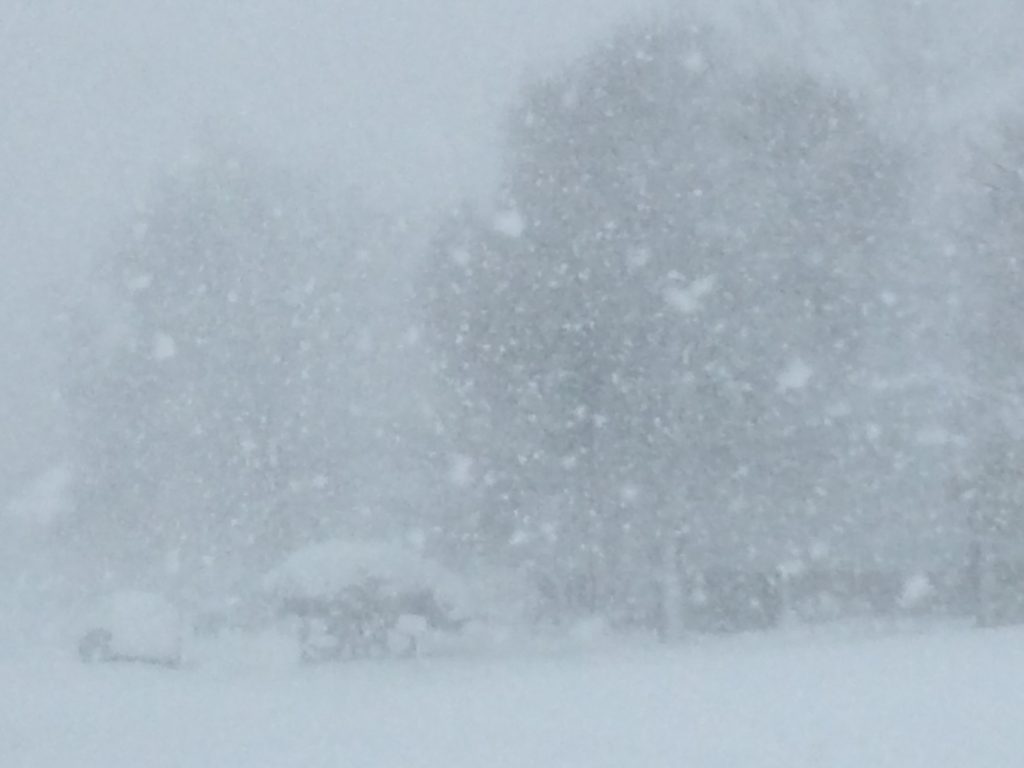
The storm initially started as rain across the plains but quickly transitioned to heavy snow early Wednesday morning. By the morning commute, snowfall rates of 1 to 2 inches per hour were common, and road conditions deteriorated rapidly. Near-zero visibility and significant snow accumulation led to major travel disruptions:
- Road Closures: The Colorado Department of Transportation (CDOT) enacted its first-ever traction law for the Denver metro area, requiring four-wheel drive or snow tires for all passenger vehicles. Major highways, including I-25 near the Wyoming border, I-70 east of Airpark Road, and Highway 287 northwest of Fort Collins, were shut down. By midday, most roads, including major portions of I-25, I-70, and I-76, were impassable. Thousands of vehicles became stranded, with over 2,000 vehicles trapped on I-25 near Monument Hill alone.
- Air Travel Disruptions: Denver International Airport was forced to cancel approximately 1,300 flights and shut down for about seven hours. This marked only the third time in the airport’s history that it had completely closed due to weather.
- Power Outages: Heavy, wet snow accumulated on trees and power lines, leading to widespread power outages. Xcel Energy reported that 290,000 customers in the Denver area lost electricity, with more than 50,000 still without power by Wednesday evening. Even the National Weather Service (NWS) in Boulder experienced power failures, requiring backup services from NWS Pueblo.
The Peak of the Blizzard
By early Wednesday, the storm had fully developed, with the upper low intensifying over southeastern Colorado. The surface low pressure system shifted into Kansas, but another area of low pressure remained over eastern Colorado, leading to prolonged and heavier snowfall than initially forecast. Snowfall rates of 2 inches per hour shifted eastward in the morning but later stalled and moved back toward the Front Range foothills between 8:30 AM and 11:00 AM—an unusual meteorological occurrence.
The most extreme conditions occurred between late morning and early afternoon, with snowfall rates reaching up to 4 inches per hour in some locations. Winds gusting between 40-55 mph created true blizzard conditions, making travel nearly impossible. Radar data showed reflectivity values of 30-40 dBZ, indicating exceptionally heavy snowfall.
Storm’s End and Aftermath
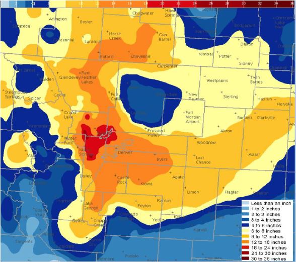
The storm’s peak intensity lasted through the afternoon, significantly impacting travel and daily activities across the region. Snow intensity began to taper off by late afternoon, and by the evening, the storm had moved eastward into the Central Plains. Final snow totals ranged from just a few inches on the northeast Colorado plains to nearly two feet in northwest Denver and the Front Range foothills—significantly exceeding early forecasts.
Conclusion
The March 23, 2016 blizzard was a historic storm that showcased the rapid intensification and unpredictability of Colorado’s spring weather. With its record-setting snowfall rates, extreme winds, widespread road closures, and power outages, this blizzard remains one of the most impactful winter storms in recent state history. Fortunately, despite the extensive disruptions, no direct fatalities were reported—a testament to the preparedness and response efforts of emergency services and meteorologists.