The genesis of Doppler radar can be traced back to the Doppler effect, a phenomenon proposed by Austrian physicist Christian Doppler in 1842. This principle elucidates the variation between the observed frequency and the emitted frequency of a wave for an observer in motion relative to the source of the waves. Common examples of this effect include the change in pitch of a siren as it approaches and then passes an observer.
Early Advances in Doppler Radar
The inception of utilizing Doppler radar for meteorological purposes has a rich history spanning several nations. However, it was not until the 1950s that concerted efforts to apply the Doppler principle to radar systems gained momentum. Researchers discerned the potential of Doppler radar in detecting and tracking various weather phenomena, particularly tornadoes.
Union City Tornado: A Watershed Moment
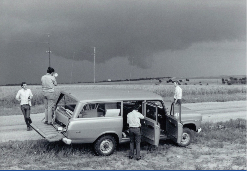
On May 24, 1973, the town of Union City in central Oklahoma bore the brunt of a violent F-4 tornado, leaving behind widespread devastation. Nevertheless, amidst the destruction, this calamity heralded a pivotal moment: it marked the maiden occasion when researchers could observe the entire lifecycle of a tornado using radar technology. The tornado’s trajectory brought it into close proximity to the NOAA National Severe Storms Laboratory (NSSL), which had recently commissioned the experimental Norman Doppler Radar.
The data and observations amassed on that fateful day represented a quantum leap in meteorological understanding. For the first time, researchers gained a holistic perspective on the behavior of a tornado, transcending mere isolated snapshots.
Unveiling the Tornadic Vortex Signature (TVS)
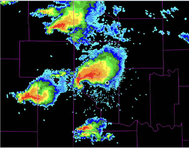
– Analysis of Doppler radar data unveiled a pivotal rotational signature aloft within the storm approximately 15 to 25 minutes before the tornado touchdown. This discernible pattern was christened the tornadic vortex signature (TVS).
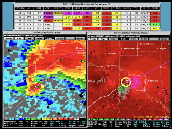
– The advent of TVS provided actionable insights and substantially bolstered tornado warning lead times. Consequently, forecasters could issue timely warnings, affording the public precious additional moments to enact life-saving measures.
Implications of Doppler Radar
– The advent of Doppler radar heralded a paradigm shift in weather forecasting, particularly concerning tornadoes.
– Through initiatives like the NEXRAD program (Next Generation Radar), Doppler radar facilitated the quantitative assessment of storm rotational velocities. By scrutinizing velocity alterations between successive scans, forecasters gained the capacity to make well-informed decisions regarding warning dissemination.
– The upshot? Markedly enhanced tornado warning lead times, directly translating to heightened public safety.
– Initially, Doppler radar data from Union City languished unseen for an extended duration. Recorded on magnetic tape, it necessitated computer processing before researchers could conduct thorough analyses.
– Nonetheless, armed with a comprehensive understanding of a tornado’s lifecycle, researchers were cognizant of the pivotal role radar technology could play in furnishing expedited, precise warnings.
In summation, the Union City tornado and NSSL’s pioneering strides with Doppler radar laid the groundwork for momentous breakthroughs in tornado forecasting and warning systems. Doppler radar endures as an indispensable instrument in our relentless quest to safeguard lives and property during inclement weather events.
Source: NOAA’s National Severe Storms Laboratory