On March 13th-15th, the Denver metro area was hit by a formidable winter storm, unleashing heavy, wet snowfall that wreaked havoc across the region. Beginning as rain in the mountains and foothills on March 13th, the storm transformed into a deluge of snow across Denver and Boulder during the late evening, catching many residents off guard. The snowstorm intensified on March 14th, blanketing the area with relentless snowfall, creating impossible travel conditions and widespread power outages.
Travel conditions quickly deteriorated, rendering roads impassable in the foothills, and leading to the closure of major highways like I-70. Stranded vehicles littered roadways, while residents found themselves trapped in their homes for days. The weight of the heavy snow caused numerous tree limbs to snap, resulting in scattered power outages that affected over 113,000 customers.
The Denver International Airport (DIA) experienced disruptions, with approximately 800 flights canceled. School closures were widespread, spanning both Thursday and Friday, as authorities grappled with the storm’s aftermath.
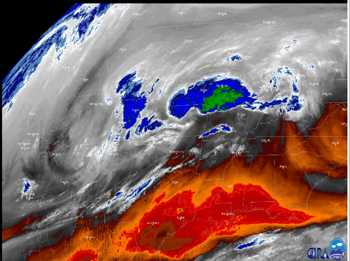
What made this storm remarkable was its atypical trajectory. Unlike typical March snowstorms that originate from the Four Corners region, this storm followed an unusual path, originating from Idaho and descending southward into Nevada before veering east towards Colorado. Despite its unconventional path, the storm packed a powerful punch, fueled by an influx of moisture and unstable atmospheric conditions.
The storm also had an exceptional liquid equivalent precipitation, equivalent to 20% of the average annual precipitation in some areas. Factors such as deep upslope flow and atmospheric instability contributed to the storm’s intensity, resulting in heavy, wet snowfall rates of up to three inches per hour. The snowfall was so wet and heavy that it would melt on top of itself throughout most of this event. In other words, even with 1.0” per hour snowfall rates, snow would still melt underneath, resulting in decreased overall snowfall totals in some locations.
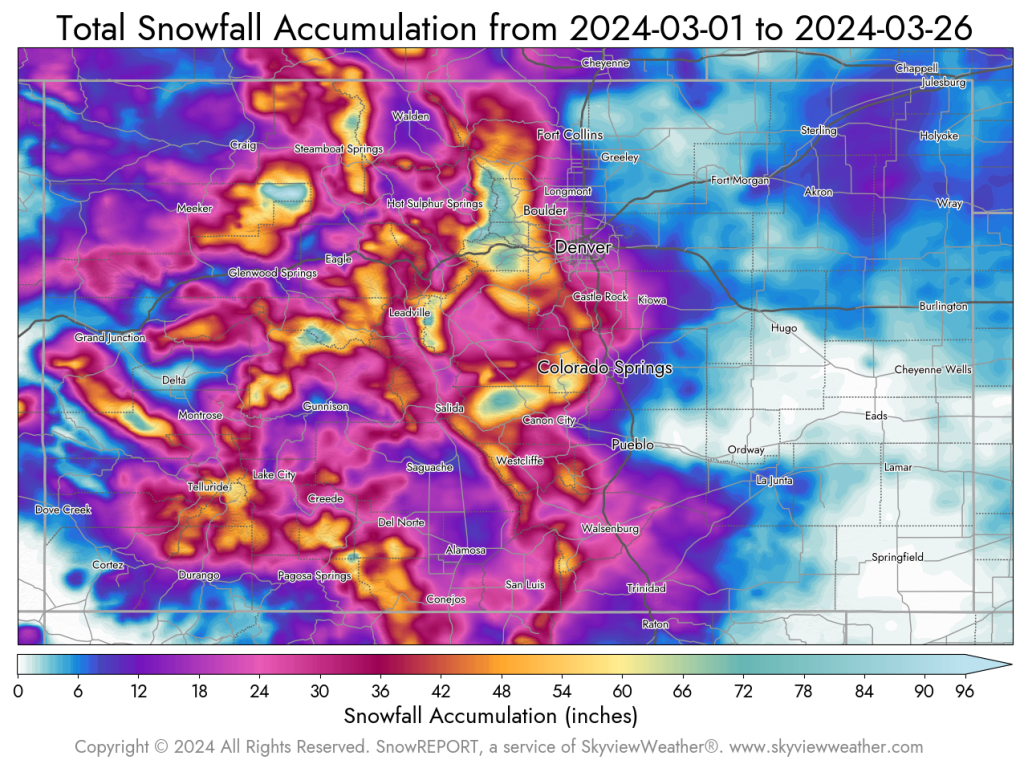
Snowfall totals during this event for the northeastern Denver Metro area were between 8.0”-16.0”. Boulder south through Jefferson County received between 12.0”-20.0”. More Douglas with anywhere between 16.0”-28.0”. The Palmer Divide was recorded between 24.0”-30.0” during this event. The foothills towards the Continental Divide had an astonishing amount of snowfall during this event with 3.0-5.0’ of snowfall recorded in that region.
This storm, while impactful, did not overtake the top 5 snowstorms that Denver has experienced. March 17th-19th, 2003 still stands at number 1 at 31.8” for Denver. March 13th-14th , 2021 is in second place with 27.1” in Denver. March 5th– 6th, 1983 still holds third place at 18.7” for Denver. Below is a map of Colorado depicting the snowfall so far for March 2024. While we have had a couple small storms, the majority of the snowfall totals are from this March 13th-15th, 2024 storm.