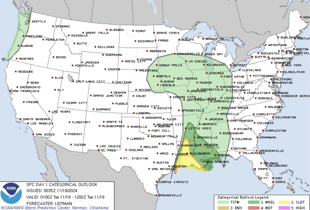
A potent storm system moving across the United States is set to deliver a double punch of weather impacts this week. While Colorado and the central Rockies brace for snowfall and a sharp drop in temperatures, the Lower Mississippi Valley and Gulf Coast face a heightened risk of severe thunderstorms, including damaging winds and tornadoes.
Severe Weather Threat Across the Deep South
The National Weather Service (NWS) has issued a Slight/Marginal Risk of Severe Thunderstorms for parts of southeast Texas, Louisiana, and southern Arkansas through Tuesday evening. The primary threats include strong winds and isolated tornadoes as thunderstorms intensify along a cold front sweeping through the region.

Storms are expected to develop in the afternoon and continue into the evening hours, fueled by a moist and unstable airmass. However, the severe potential is likely to diminish after sunset as cooler temperatures stabilize the atmosphere.
The best chance for severe weather will be in areas of far southeastern Louisiana, southern Mississippi, and southern Alabama, where dewpoints in the low 70s will support modest instability. A combination of strong low-level wind shear and veering winds will further enhance the tornado threat.
Timeline and Areas of Concern
- Overnight Tonight: As the cold front progresses eastward, the severe weather threat is expected to weaken significantly, with storms losing intensity due to cooling surface temperatures.
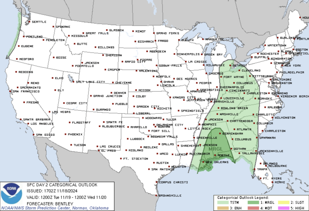
- Tuesday: Isolated thunderstorms may still impact the Gulf Coast, including the Florida Panhandle, southern Alabama, and Mississippi. However, the severe weather potential will be more limited compared to today.
Snow and Cold Air Behind the Front
On the other side of the system, Colorado and the Rockies will experience the wintery impact of this storm. Cold air surging in behind the front is expected to deliver accumulating snowfall and strong northwest winds, leading to much colder conditions across the region. Temperatures will drop into the 40s and 50s across much of the South by Tuesday, with some areas in the central U.S. potentially seeing freezing temperatures later in the week.
Challenges to Severe Weather Development
While the ingredients for severe storms are present—moisture, wind shear, and an approaching cold front—there are limiting factors. Extensive cloud cover and earlier rainfall could suppress surface heating, reducing instability. A capping inversion in parts of the region may also inhibit thunderstorm formation.
However, any storms that manage to break through these inhibiting factors could quickly become severe, with the potential for damaging winds and isolated tornadoes.
What to Expect Tomorrow
As the front moves eastward, the severe weather risk shifts to the central Gulf Coast. A Marginal Risk of Severe Thunderstorms remains in place for parts of southern Mississippi, Alabama, and the Florida Panhandle. Damaging winds and isolated tornadoes are possible, but the overall threat will be lower than on Monday due to weakening atmospheric forcing.

This storm system showcases the contrasting impacts of late autumn weather across the U.S. While the Rockies prepare for snow and frigid air, the Deep South must brace for the possibility of damaging storms. Stay informed and stay safe as this dynamic system moves through.
