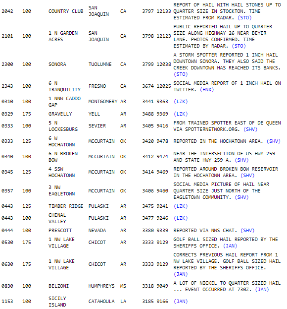
As expected, a round of overnight severe weather impacted the far eastern Oklahoma area and into Arkansas. Fortunately due to minimal daytime heating, most storms did not produce any significant severe weather, however there were reports of hail up to 1.75” for some areas. Below is a list of hail reports from the evening, and through the overnight:

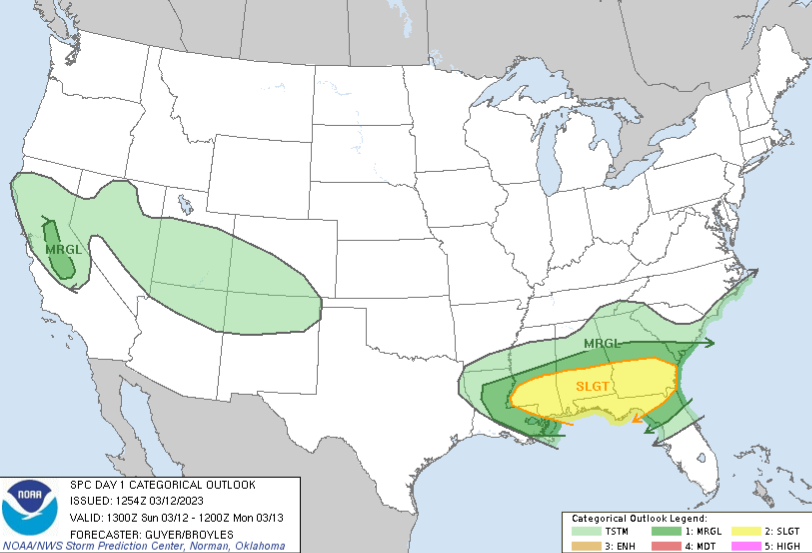
Additional severe weather will be likely today and into this evening for portions of the southeastern United States as seen below in the Convective Outlook provided by the National Weather Services Storm Prediction Center. These storms could bring another round of hail, up to 1.5”, strong winds 60+mph and cannot rule out an isolated tornado or two (EFO-EF1 Range). The best chance for these storms will be from now, through nightfall, with storm intensities decreasing into the later evening, with mostly rain showers through daybreak tomorrow.

