Get ready for some weather action this week: A quick round of light snow across the Colorado/Wyoming border tonight followed by a potential winter storm system Thursday. Here’s a quick breakdown:
Tuesday:
An upper-level trough moves in, bringing southwest flow and potential freezing drizzle from Denver to the Wyoming border. While mountain peaks might see a few snow showers, the plains should stay dry in the afternoon with highs in the mid-30s to lower 40s.
Tuesday night to Wednesday:
The trough heads southeast, creating a chance for rain or snow showers in the far southeast areas. However, dry conditions are expected for most, with highs in the upper 30s to lower 40s in northeastern Colorado. Meanwhile, a cut-off low develops over the Great Basin and begins to meander southeast [Fig. 1].
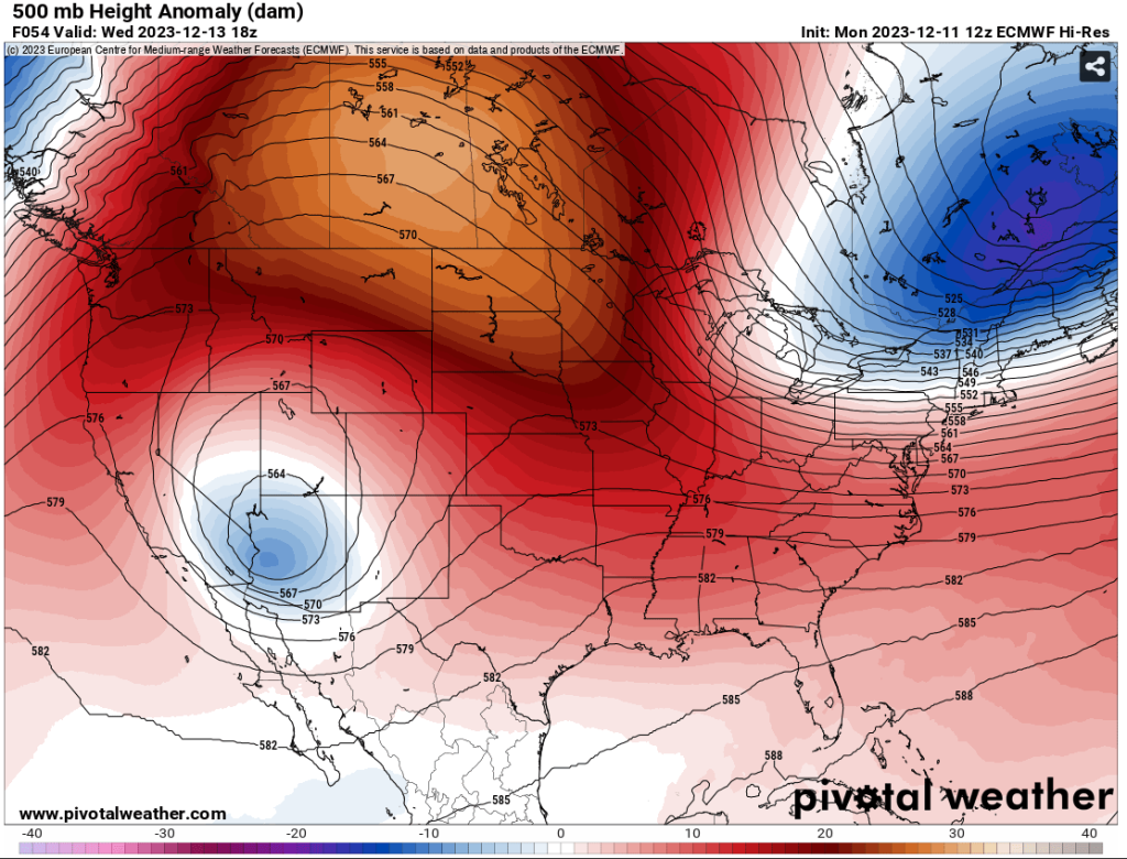
Fig 1- 500mb Height Anomaly. Model: ECMWF. 12-13-23 18Z via Pivotal Weather
Wednesday night to Thursday:
Models are a bit undecided on the track of this winter storm. On Thursday, the NAM is favoring the low to stay slightly more south, keeping most precipitation towards the southeast, while the GFS and ECMWF suggest a bit more action south of the Palmer Divide with the low centered slightly more to the north. In general, long-range ensembles suggest this system will dig southeast of the Four-Corners area by Thursday [Fig 2].
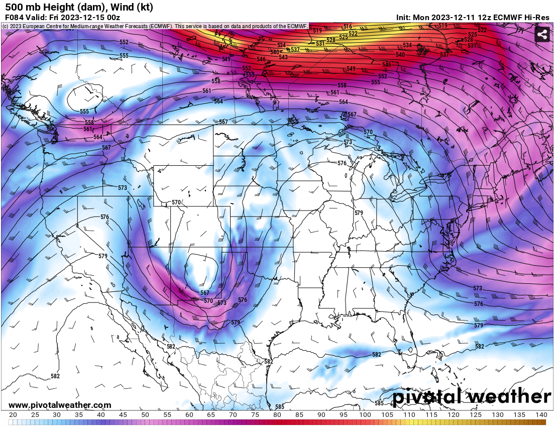 | 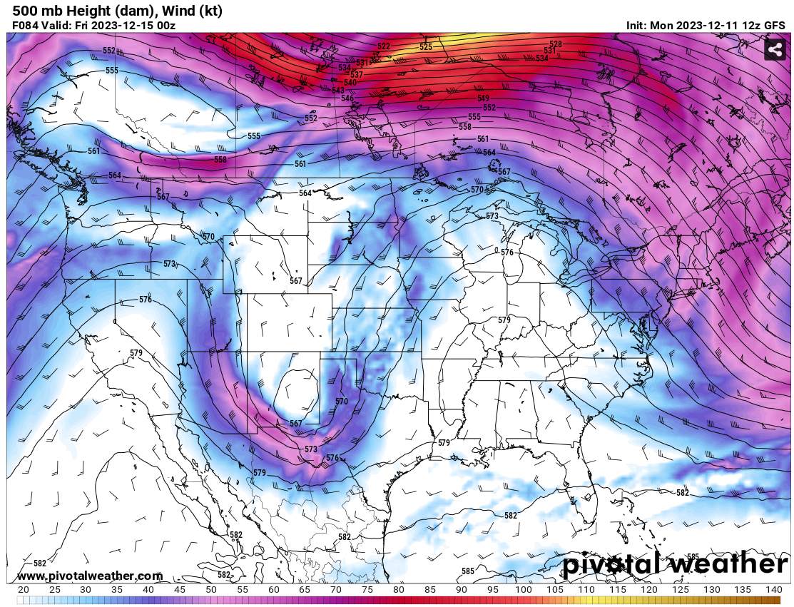 | 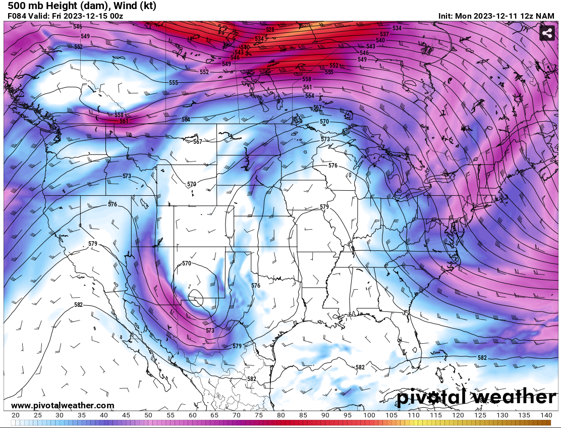 |
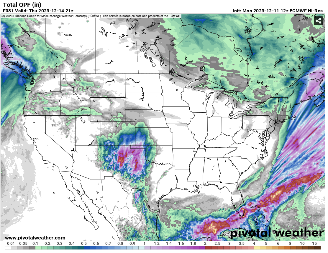 | 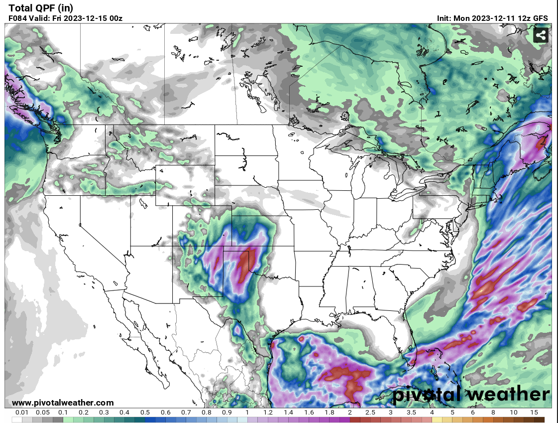 | 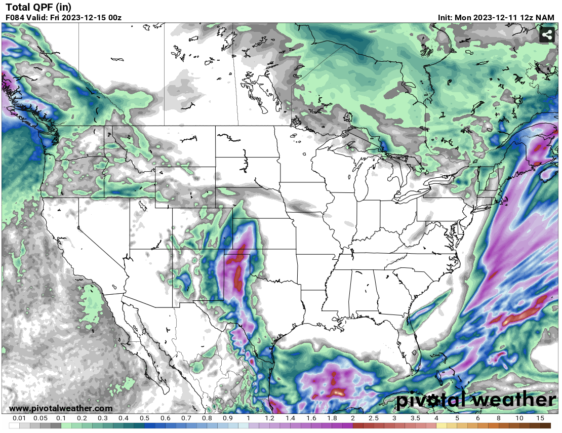 |
A setup such as this can support significant snow in areas of eastern Colorado, specifically south of the Palmer Divide. Time will tell if the low will be strong enough to withstand the significant ridge to the east. Confidence is moderate, and Thursday’s highs should be near seasonal norms.
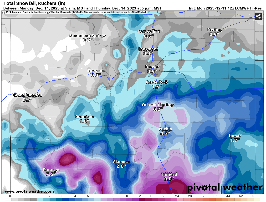
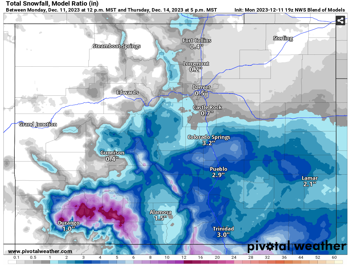
Right now, it looks like most of the heavier precipitation will stay to the south of the Palmer Divide [Fig. 3]. The NWS Blend is showing snowfall totals from 1-5’’ while the ECMWF is favoring larger snowfall totals around 1-9” (depending on elevation). As time goes on, hopefully, more precise snowfall totals will be favored. Until then, stay weather-aware and follow us on social media for more information.
 |  |
For full forecasts and information on how to get them for your specific area, please email [email protected]