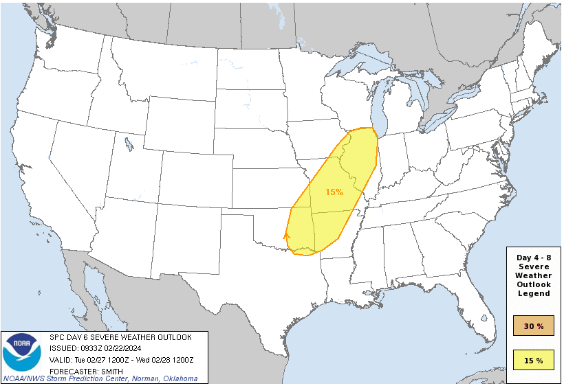
As we brace ourselves for the arrival of spring thunderstorms, Mother Nature seems poised to remind us of her power before February ends. The Midwest and Deep South are facing the potential for severe weather including tornadoes, on Tuesday and Wednesday of next week. While the exact details remain uncertain, the ingredients are coming together for a potentially volatile atmospheric event and could be the first large tornado outbreak of 2024. The SPC has already issued a severe potential of 15% as of today [Fig. 1].
 | 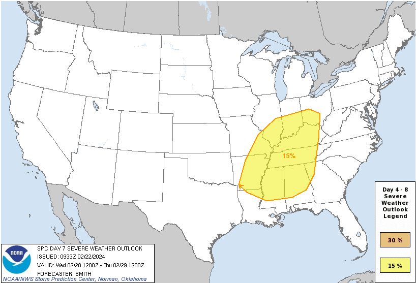 |
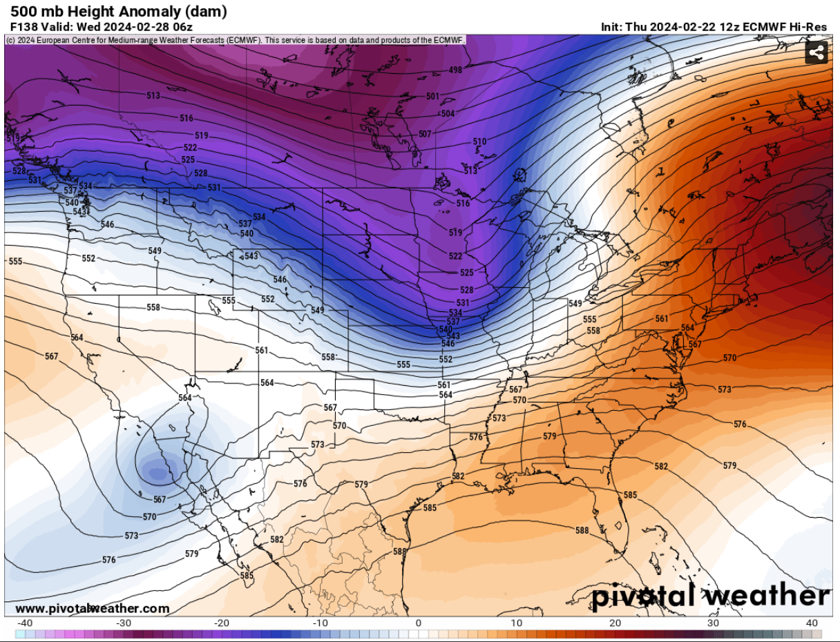
A potent mid- to upper-level trough [Fig. 2] will sweep into the central U.S. by midweek. A deep cyclone is expected to traverse from the central Great Plains into the Great Lakes region.
 |
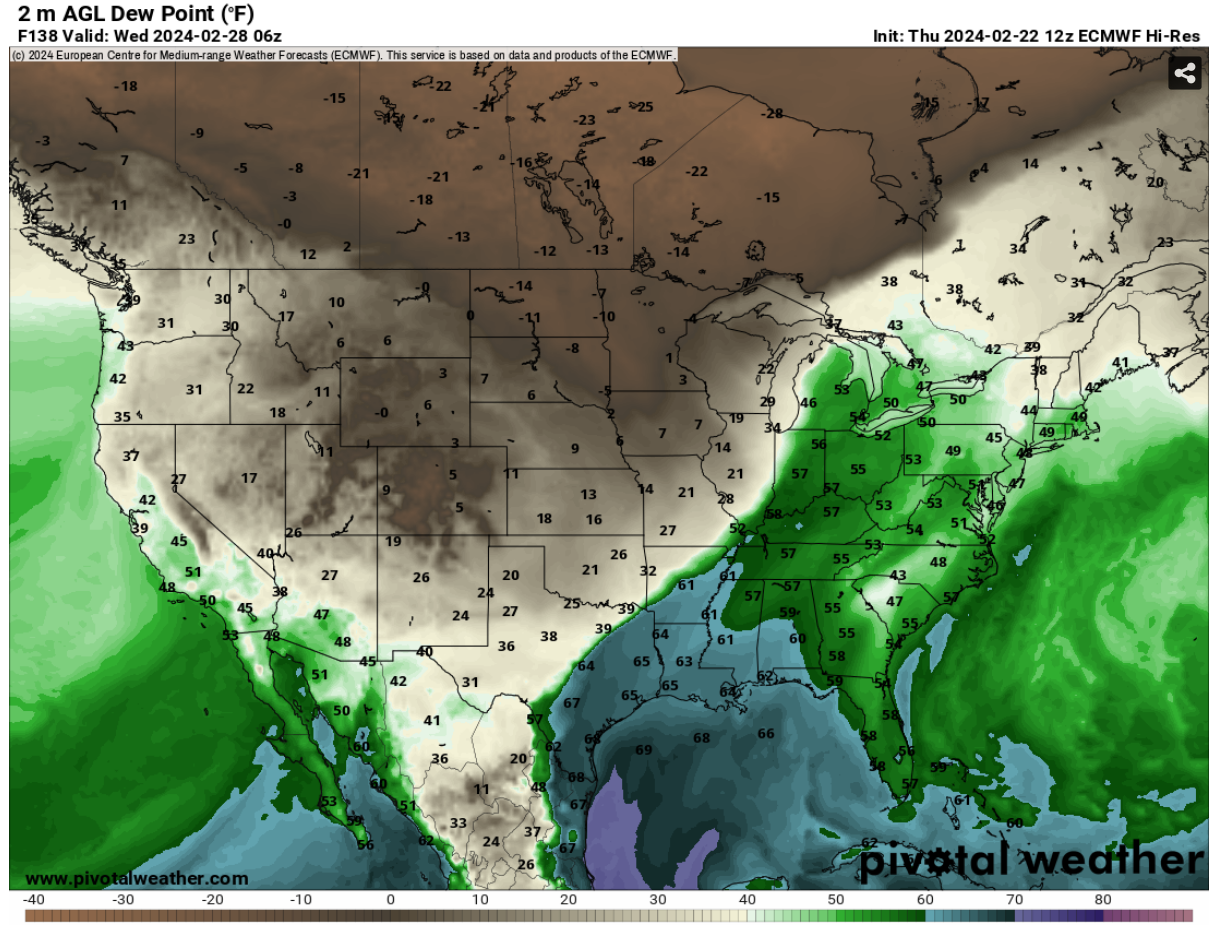
Ahead of this system, there’s a notable build-up of steep lapse rates associated with an elevated mixed layer over the Texas Panhandle Region. Additionally, moisture from the Gulf of Mexico is set to feed into the region [Fig. 3], creating a conducive environment for severe weather development.
 |
With the convergence of these atmospheric conditions, there’s an increased risk of severe thunderstorms, including hail, strong winds and tornadoes. While it’s still too early to pinpoint the exact timing, impacts, and locations of these storms, residents in the affected regions are urged to stay vigilant and monitor updates from local authorities and meteorological agencies.