As we enter meteorological fall, thunderstorms remain a threat across parts of the northern Rockies, Great Basin, and adjacent High Plains. The National Weather Service’s Storm Prediction Center (SPC) has issued a marginal risk for severe thunderstorms in these areas for today, September 3, 2024. As we look to tomorrow, September 4, 2024, the risk will expand across the central Rockies, High Plains, and parts of the Midwest.
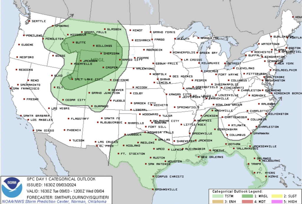
Day 1 (Today, September 3, 2024): Northern Rockies and Great Basin
Even though fall has begun, today’s weather pattern is reminiscent of late summer, with scattered thunderstorms expected across the northern Rockies and parts of the Great Basin this afternoon. An upper-level low currently over central Idaho is set to move toward southwestern Montana and eastern Idaho by tonight. This feature is already generating increased cloud cover and convective activity, as shown on satellite imagery. With daytime heating, thunderstorms will develop over the higher terrain in Idaho, Montana, and Wyoming.
Forecast models indicate moderate instability, with CAPE values ranging from 500 to 1,000 J/kg across southwestern Montana into northwestern Wyoming. These storms could briefly intensify into transient supercells, with a risk of large hail and damaging winds. As the evening progresses, storms will likely move eastward into south-central Montana and northern Wyoming.
Further south, isolated high-based thunderstorms are anticipated across northern Utah and eastern Idaho, with strong wind gusts possible as these storms move east-northeastward into Wyoming.
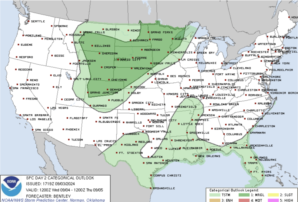
Day 2 (Tomorrow, September 4, 2024): Central Rockies, Plains, and Midwest
Tomorrow’s severe weather threat will spread over a larger area, including the central Rockies, central High Plains, northern Plains, and Midwest. A broad upper-level trough will strengthen over the northern Plains, bringing scattered thunderstorms to the region, particularly in the afternoon and evening.
In the central Rockies, cold air aloft will interact with strong surface heating, leading to scattered thunderstorms across the higher terrain. While most storms will be disorganized due to weak wind shear, isolated strong wind gusts and hail may still occur.
A more organized wind shear profile is expected along the southern edge of the trough, affecting areas from eastern Utah to northern Colorado, western Nebraska, and southwest South Dakota. However, storm coverage may be limited due to warmer temperatures aloft, which could suppress convection.
Over the Midwest, a mid-level shortwave trough will move across the Dakotas, triggering thunderstorms along a cold front. While moisture levels will be somewhat limited during the day, an intensifying low-level jet overnight will increase moisture and result in more widespread thunderstorm activity across eastern Minnesota and northwestern Wisconsin. These overnight storms could produce large hail and damaging winds, with the severe threat continuing into the early morning hours of Thursday.
Conclusion
As we transition into meteorological fall, thunderstorms are still very much in the picture. Over the next 48 hours, residents in the affected regions—including the northern and central Rockies, central High Plains, northern Plains, and Midwest—should remain weather-aware. Although the overall severe threat is marginal, isolated strong storms could bring damaging winds and hail. Stay tuned to local weather updates and be prepared to take action if severe weather approaches your area.