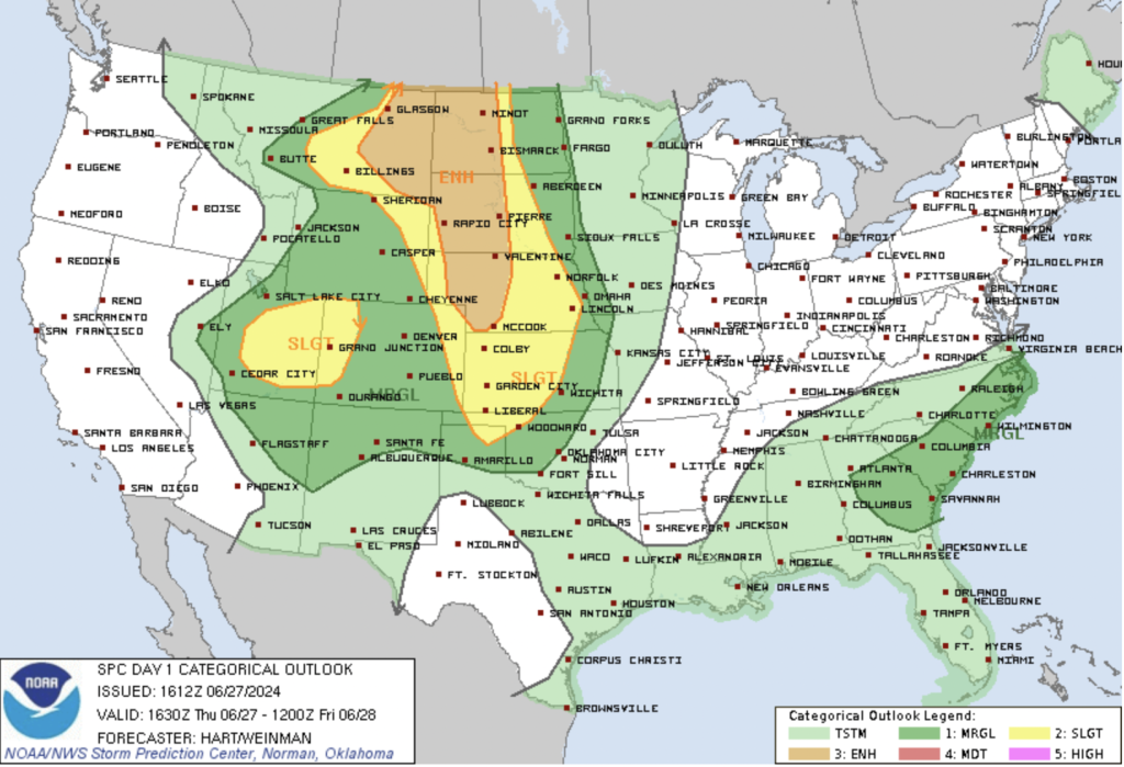
Overview:
Today, portions of Colorado face an enhanced threat of severe thunderstorms, particularly over portions of the central and northern High Plains. The National Weather Service (NWS) has issued an enhanced risk of severe weather, with the potential for gusts near 80 mph, hail larger than 2.5 inches, and a few potential tornadoes.
Synopsis:
The surface analysis at 11Z shows a cold front across western Montana, central Idaho, and northern California, with a warm front extending from Montana to northern Nebraska. Cyclogenesis is expected over Montana throughout the day, with the main low moving to the Montana-North Dakota border by 00Z. A dryline will sharpen over the High Plains, extending from eastern Colorado to the western Texas Panhandle by 00Z.
Great Plains:
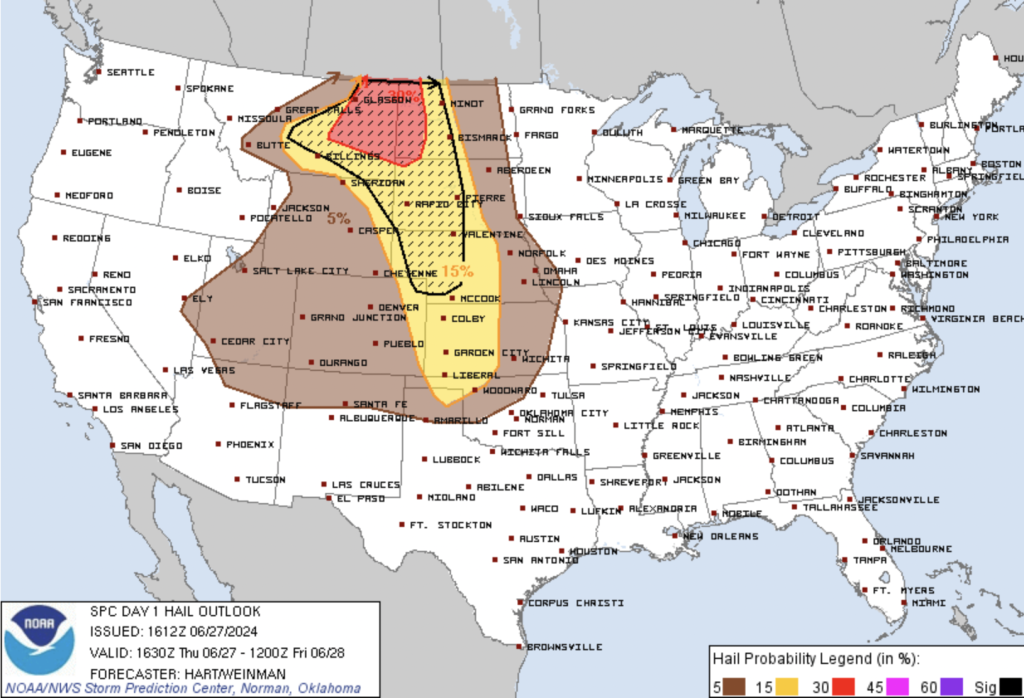
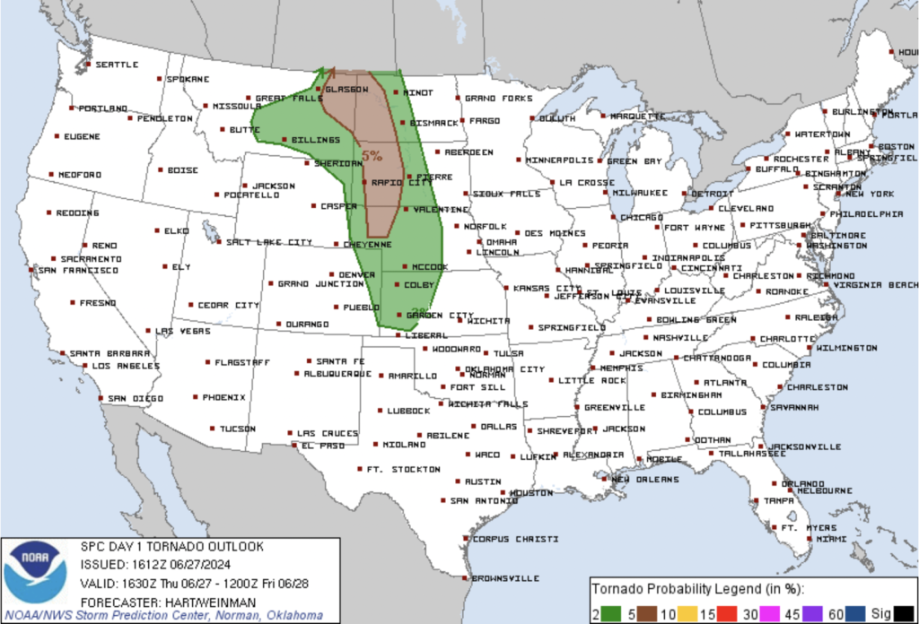
Scattered thunderstorms are expected over the northern and central Plains, beginning late morning through the afternoon in Montana, where large-scale lift will be strongest. Severe gusts (over 70 mph) and large hail (over 2 inches in diameter) are the main concerns. Later development near the surface low, dryline, and warm front in northeastern Montana and western Dakotas could produce large hail, severe gusts, and tornadoes.
In the central and northern High Plains, deep-layer shear will strengthen, heating will reduce inhibition, and regional lift will increase, supporting severe storm development. Effective-shear magnitudes of 40-55 kt will favor supercell potential with destructive hail.
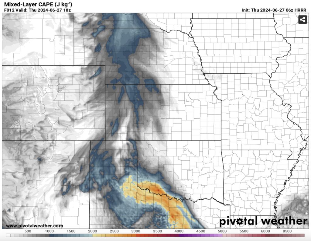
Utah and Western Colorado/Wyoming:
Widely scattered thunderstorms will form in the afternoon due to the moist, well-heated boundary layer. These storms may produce severe gusts, large hail, and a marginal tornado threat. Diurnal heating and orographic lift will support MLCAPE of 500-1500 J/kg. While flow is nearly unidirectional, terrain-forced backing will enhance deep shear locally, supporting multiple storm cells and a few supercells. Heavy rainfall over the mountains and valleys may lead to flash flooding, particularly in burn scar areas. Quick storm movement should mitigate widespread flash flooding, but localized issues are possible.
Conclusion:
Colorado will experience a mix of severe weather threats today, with the highest risks in the far northeast regions. Heavy rainfall and flash flooding are possible in mountainous areas. Residents and travelers should stay updated with the latest weather information and be prepared for rapidly changing conditions.