Today, the Great Plains are witnessing a clash of seasons, with significant weather events unfolding across the region. Denver marked its first measurable snow of the season, while farther southeast, severe thunderstorms, including the potential for strong tornadoes, are impacting parts of Oklahoma, Texas, Arkansas, and Missouri.
Snowfall in Colorado
Denver woke up to the sight of snowflakes blanketing the area, marking the first measurable snowfall of the season. This snowfall comes as a strong cold front pushes through Colorado, ushering in a wintry scene across the Front Range. The storm has brought a sharp contrast to the unseasonably warm and dry conditions experienced in recent weeks.
Tornado Threat Across the Southern Plains
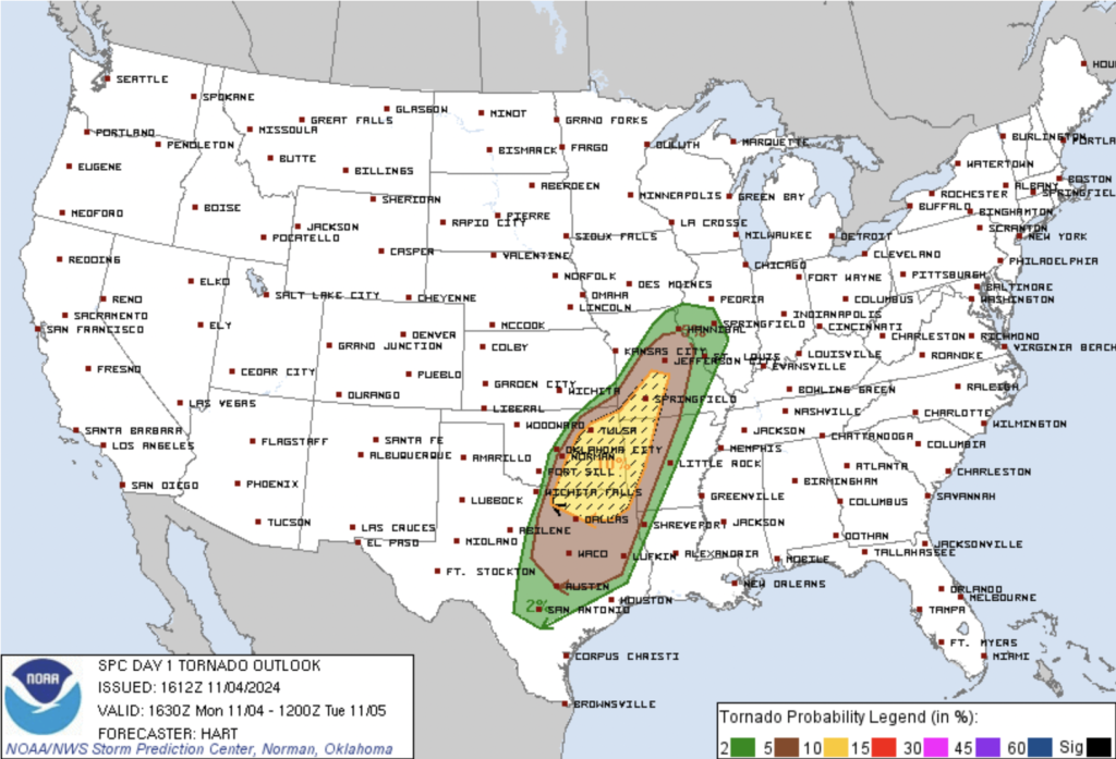
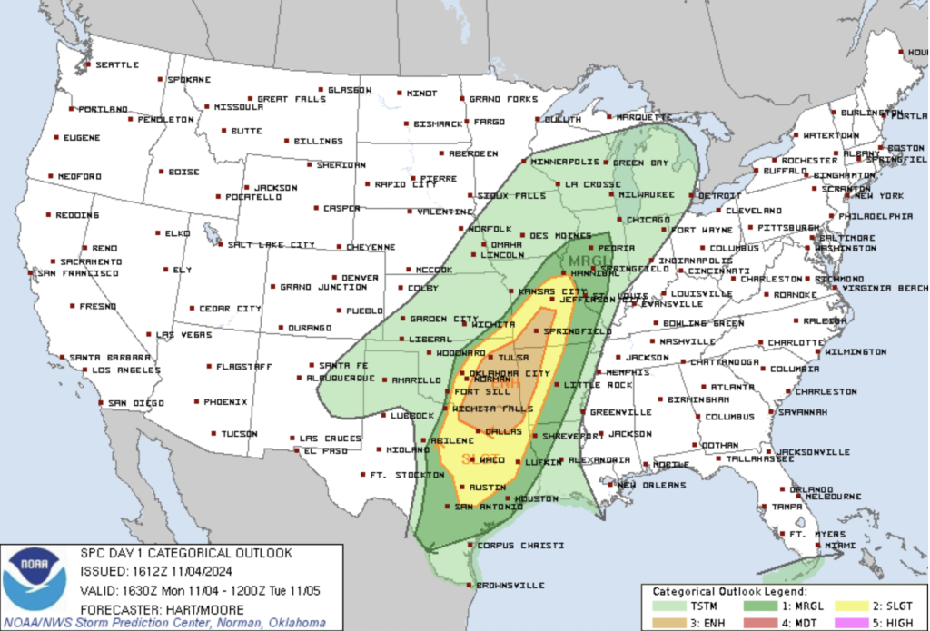
Meanwhile, as snow falls to the west, a severe weather outbreak is unfolding across the Southern Plains and Ozarks. The Storm Prediction Center (SPC) has issued an Enhanced Risk for severe thunderstorms this afternoon and evening, covering parts of northeast Texas, eastern Oklahoma, western Arkansas, and southwest Missouri. The atmosphere is primed for a dangerous storm event, with the potential for tornadoes—some possibly strong—along with large hail and damaging wind gusts.

Atmospheric Setup for Severe Storms
The ingredients for severe weather are aligning as a deep upper trough shifts from the southern Rockies into the Plains. A powerful jet stream is sweeping into west Texas, creating dynamic wind shear and instability across a broad area. Southerly low-level winds are drawing moisture from the Gulf of Mexico, setting the stage for rapid thunderstorm development. Current conditions include dew points in the upper 60s and pockets of daytime heating, contributing to a highly unstable air mass.
Morning storms have complicated the forecast, particularly in central Oklahoma, as they have left boundaries that may influence where new storms form. Nonetheless, intense convection is expected by early afternoon, likely a mix of bowing storm structures and discrete supercells. These storms will track northeast, bringing a significant risk for tornadoes, damaging winds, and large hail.

Timeline and Key Areas of Concern
Storms are expected to initiate near the surface boundary extending from central Oklahoma southward into Texas, then spread northeast through the evening. The greatest tornado risk exists in eastern Oklahoma and northeast Texas, where forecast soundings indicate robust wind shear and rotation potential. Areas in western Missouri and Arkansas will also remain under threat into the evening as storms march across the region.
Along with the severe weather comes a continued risk for flash flooding, with heavy rainfall falling on already saturated ground. Flood Watches remain in effect for parts of Oklahoma and Arkansas until tonight.
Residents across the affected regions should stay weather-aware today, monitor forecasts closely, and have a plan in place to take shelter if severe weather threatens.
