Tornadoes and hailstorms are commonly associated with summer weather, yet today, portions of the Mid-South are poised to experience severe weather this afternoon. It is not uncommon for the southern states to experience severe weather in the winter months due to their access to large amounts of moisture from the Gulf of Mexico, warmer temperatures, and general instability in the area.
The National Weather Service’s Storm Prediction Center has identified a potential for severe weather, encompassing the risk of flash flooding, high winds, and isolated tornadoes. The area of concern falls under a slight chance, rated as a level 2 out of 5 for risk [Fig.1].
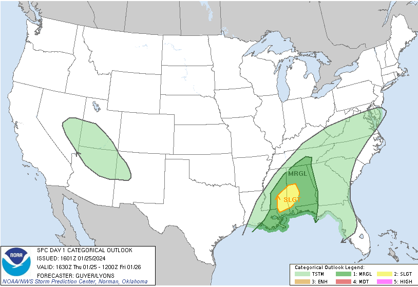
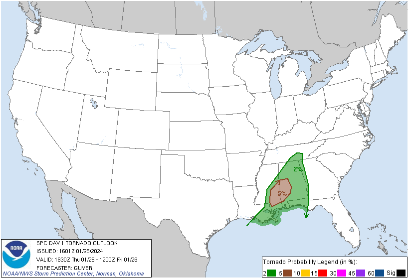
This weather phenomenon is attributed to a shortwave trough moving towards the Mississippi and Alabama area from the west this afternoon. Due to saturated soil from yesterday’s rain, flash flooding is a likely threat in some low-level areas. Parts of Mississippi are currently under a Flash Flood Watch until 6 pm CST this evening. Other than flooding, damaging straight-line winds will be a threat with this convective system, likely causing minor damage to structures and trees. This same system also has a marginal amount of low-level shear and instability which will contribute to an isolated tornado threat of 5% [Fig. 2].
Thunderstorm activity ramps up again as another shortwave moves into the area on Saturday providing another risk for severe weather in the Mid-South. The area of concern falls under a slight chance, rated as a level 2 out of 5 for risk [Fig. 3].
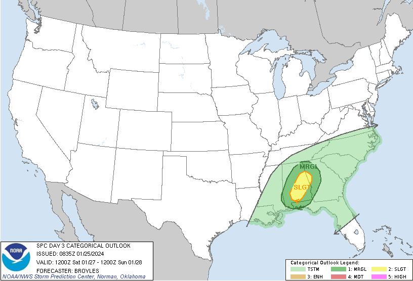
Large-scale ascent and strong shear may provide enough support for a line of thunderstorms to develop during the afternoon. High winds will be the main threat but isolated tornadoes, and flooding are not off the table as of now.
For those in this area, stay tuned to local weather updates and take necessary precautions to ensure safety during this period of heightened weather activity.