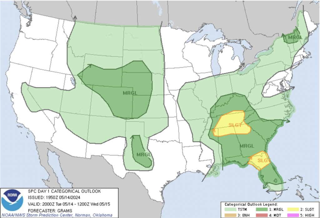
As the nation keeps an eye on weather patterns during the springtime, Colorado finds itself in a familiar position today, with scattered showers and thunderstorms on the agenda. While the state is marked under a marginal risk level for severe weather, the broader convective outlook provides a nuanced perspective on atmospheric dynamics across the country.
Here, west-northwest winds are currently drying and subsiding over the northern Front Range, tempering the formation of significant storms. Yet, scattered showers and isolated storms are still expected elsewhere, although most will likely be quick-moving and weak.
As evening approaches, a cold front will bring a change in wind direction, accompanied by the potential for additional showers and isolated thunderstorms across northern Colorado. While the threat remains marginal, there’s a chance of hail up to penny size and gusty winds in some areas.
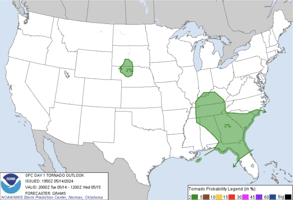
Beyond Colorado’s borders, the convective outlook highlights varying levels of atmospheric instability across different regions of the country. From the Central High Plains to Northern New England and the Caprock to the Edwards Plateau in Texas, isolated severe weather events may occur, albeit with differing characteristics and impacts [Fig. 1].
In the Tennessee Valley and North Florida, a slight risk of severe thunderstorms looms on the horizon. Here, the convergence of meteorological factors sets the stage for potentially more impactful weather events compared to Colorado’s marginal risk zone, including the possibility of isolated tornadoes.
The interplay of a midlevel trough over the lower-middle Mississippi Valley, combined with an associated surface cyclone and trailing cold front, creates pockets of surface heating along and east of the surface trough. This heating boosts the atmosphere’s instability, elevating the risk for severe thunderstorms capable of producing isolated damaging winds and large hail.
Across Florida, an initial Mesoscale Convective System (MCS) moved over north Florida and southeast Georgia earlier, leaving behind a trailing outflow boundary. As the day progresses, increased storm activity will be present along the low-level baroclinic zone, primarily in the northeast Gulf to north Florida. Fast southwesterly flow supports the formation of a couple of mid-level supercells, heightening the threat of large hail overnight. Additionally, the recovering instability may yield isolated damaging winds and the possibility of tornadoes [Fig. 2].