In an astonishing display of nature’s power, Hurricane Beryl, now a major Category 4 hurricane, has swept into the southeastern Caribbean with unprecedented speed and strength. From a mere tropical depression, Beryl intensified to a Category 4 hurricane in less than 48 hours, catching the attention of meteorologists and the public alike.
Current Status and Path
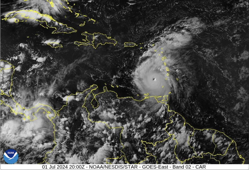
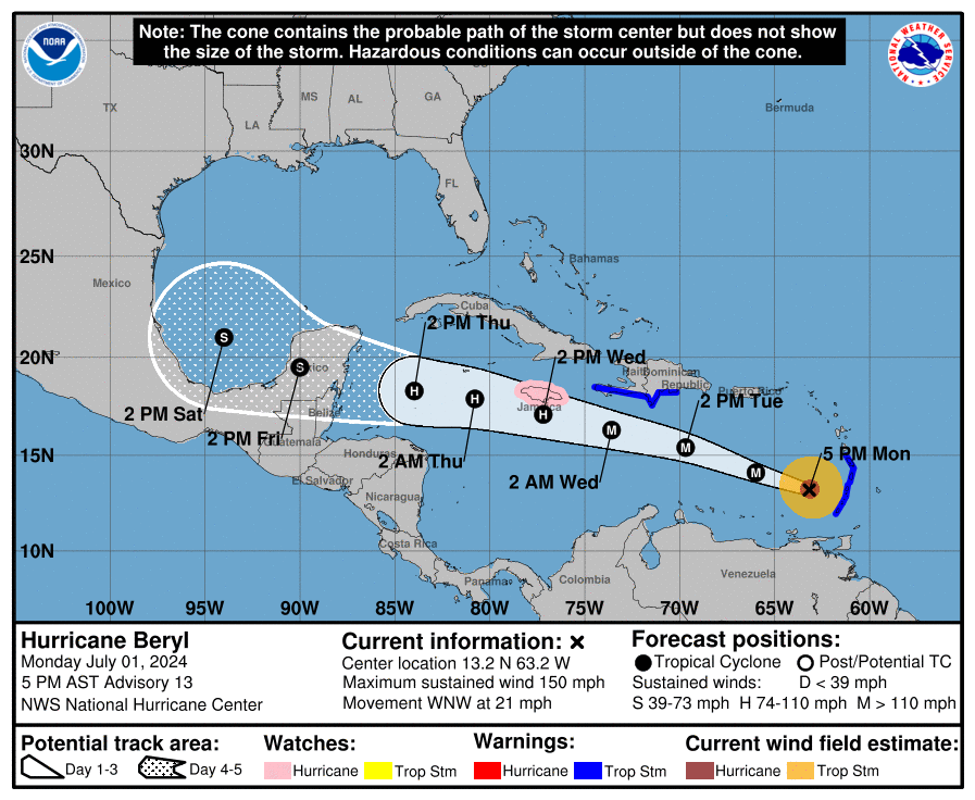
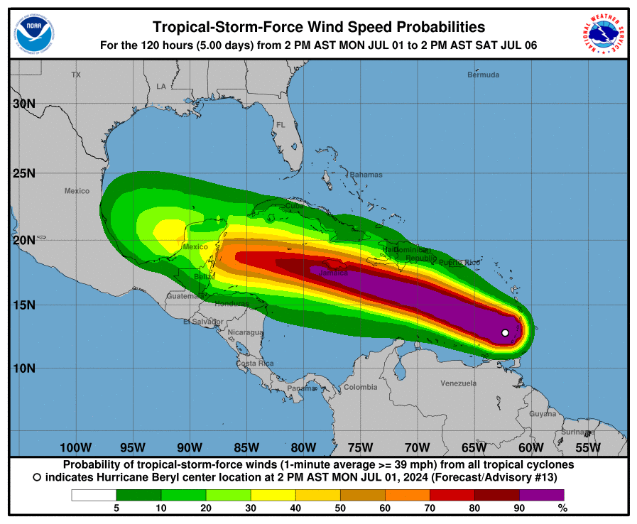
As of the latest advisory from the National Hurricane Center at 5:00 PM AST on July 1, 2024, Hurricane Beryl is churning over the southeastern Caribbean. Located at latitude 13.2 North and longitude 63.2 West, about 125 miles northwest of Grenada, Beryl boasts maximum sustained winds of 150 mph (240 km/h) and a minimum central pressure of 944 mb (27.88 inches). The hurricane is moving west-northwest at a brisk pace of 21 mph (33 km/h).
Beryl’s trajectory places it on a path that will see it moving away from the southern Windward Islands tonight, crossing the southeastern and central Caribbean Sea tonight through Tuesday, and passing near Jamaica by Wednesday.
Watches and Warnings
The rapid escalation of Beryl has prompted a series of watches and warnings across the Caribbean:
– Hurricane Watch: Jamaica
– Tropical Storm Warning: Grenada, St. Vincent and the Grenadines, St. Lucia, Martinique, the south coast of the Dominican Republic from Punta Palenque to the border with Haiti, and the south coast of Haiti from the border with the Dominican Republic to Anse d’Hainault.
Residents in these areas are advised to prepare for severe weather conditions, including strong winds, heavy rainfall, and dangerous storm surges.
Meteorological Marvel
Hurricane Beryl’s swift intensification is a stark reminder of the unpredictable and volatile nature of tropical systems. The hurricane’s eye wall replacement cycle, combined with favorable environmental conditions such as warm sea surface temperatures and low wind shear, has fueled its rapid development.
“Beryl’s rapid intensification is a testament to the advanced observation capabilities provided by our satellite technology,” said NOAA Administrator Rick Spinrad. “This data is crucial for accurate and timely weather forecasting.”
Impact and Preparations
The immediate impacts of Hurricane Beryl are already being felt across the southern Windward Islands, where tropical storm conditions, dangerous waves, and heavy rainfall persist. Residents in affected areas should heed the advice of local authorities and take necessary precautions.
– Wind: Hurricane conditions are possible in Jamaica by Wednesday, with tropical storm conditions expected in the southern Windward Islands and along the south coast of Hispaniola by late Tuesday.
– Storm Surge: Water levels could rise by 2 to 4 feet above normal tide levels in Jamaica and 1 to 3 feet along the southern coast of Hispaniola, posing significant flood risks.
– Rainfall: Beryl is expected to produce 3 to 6 inches of rain across the Windward Islands, with localized maxima of 10 inches, potentially causing flash floods.
Looking Ahead
As Beryl continues its west-northwestward march, the storm is expected to remain a major hurricane in the short term, although some weakening is anticipated by midweek as it progresses through the central Caribbean. Nevertheless, Beryl’s strength and speed underline the importance of preparedness and vigilance in the face of such powerful natural phenomena.
For those in the path of Hurricane Beryl, staying informed through reliable sources and following emergency guidelines is crucial. The National Hurricane Center and local meteorological services provide ongoing updates and advisories to help communities stay safe and mitigate the impacts of this formidable storm.
Stay tuned for further updates on Hurricane Beryl as it continues its dramatic journey across the Caribbean, reminding us all of the raw power and beauty of nature’s forces.