The classic refrain of “I’m dreaming of a white Christmas” may become a reality for Colorado this year. As anticipation builds, let’s delve into the potential for a winter wonderland in the Centennial State.
The next winter storm is set to take shape over the Great Basin this Saturday, injecting a dose of excitement into the question of a white Christmas. However, the track and intensity of this system are currently shrouded in considerable uncertainty.
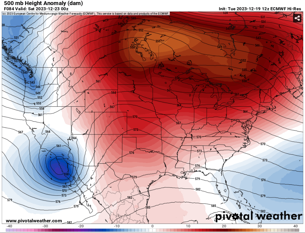
The prevailing forecast points to a southern low tracking east-northeast through the Desert Southwest and into New Mexico on Saturday, while a northern low is expected to push south in the vicinity of the Four Corners [Fig. 1]. These two systems present a complex weather pattern, offering ample potential for impactful winter weather across the High Plains and Rocky Mountains. However, the specifics of locations and the extent of impacts remain elusive.
  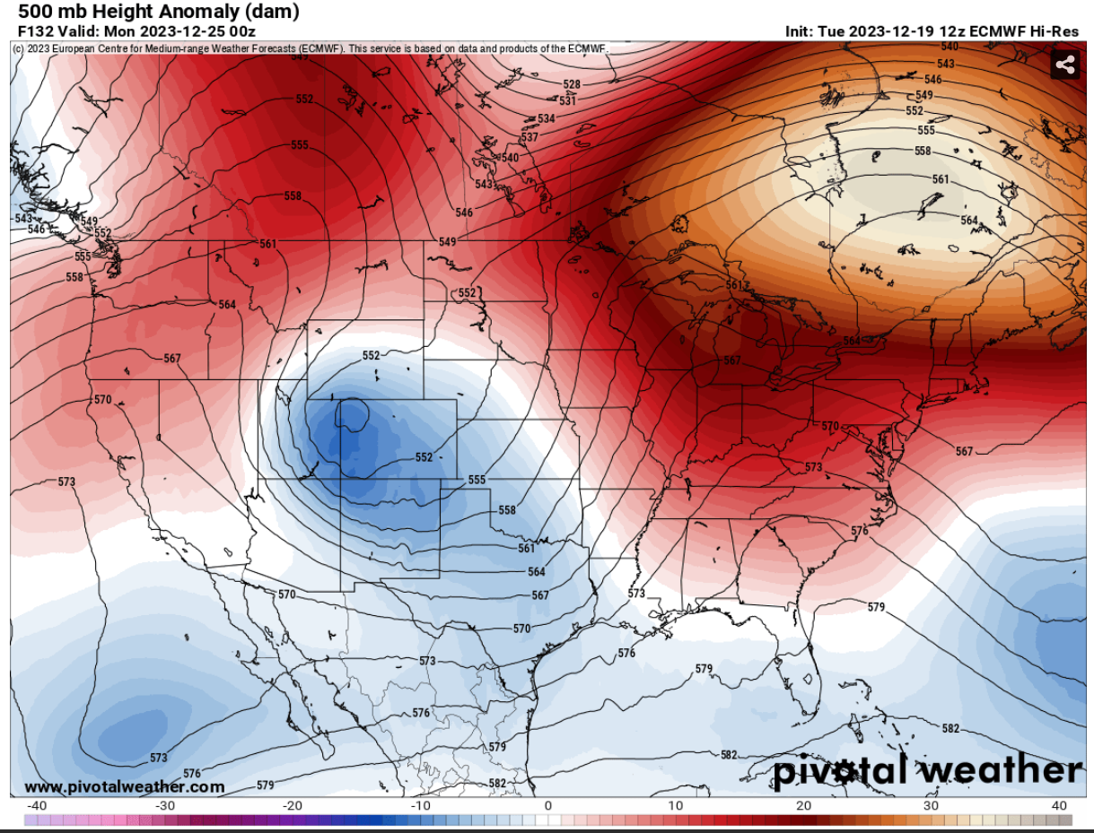 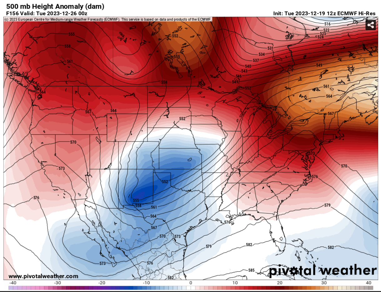 |
According to NWS Blend, precipitation chances could increase as early as Saturday, with Christmas Eve emerging as the primary period for precipitation. Most models depict a 500mb system generally over New Mexico, fostering the possibility of upslope flow and robust frontogenesis [Fig.2]. Beyond this, uncertainty looms, with some ensemble members hinting at lingering precipitation through Christmas Day, while others keep the region dry, swiftly ejecting the low eastward.

Figure 2- 500mb height and wind (kt) 12/24/23 0z Global Ensemble Forecast System via Pivotal Weather
Adding complexity to the forecast is the consideration of precipitation type. Warmer solutions suggest 700mb temperatures around 0°C, indicating the initial precipitation in the form of rain, potentially impacting snow totals.
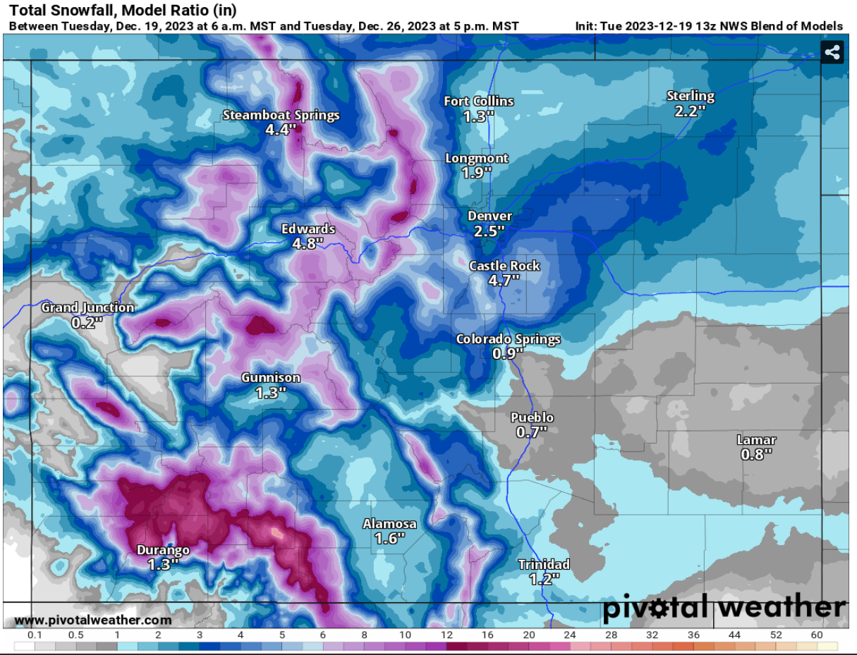
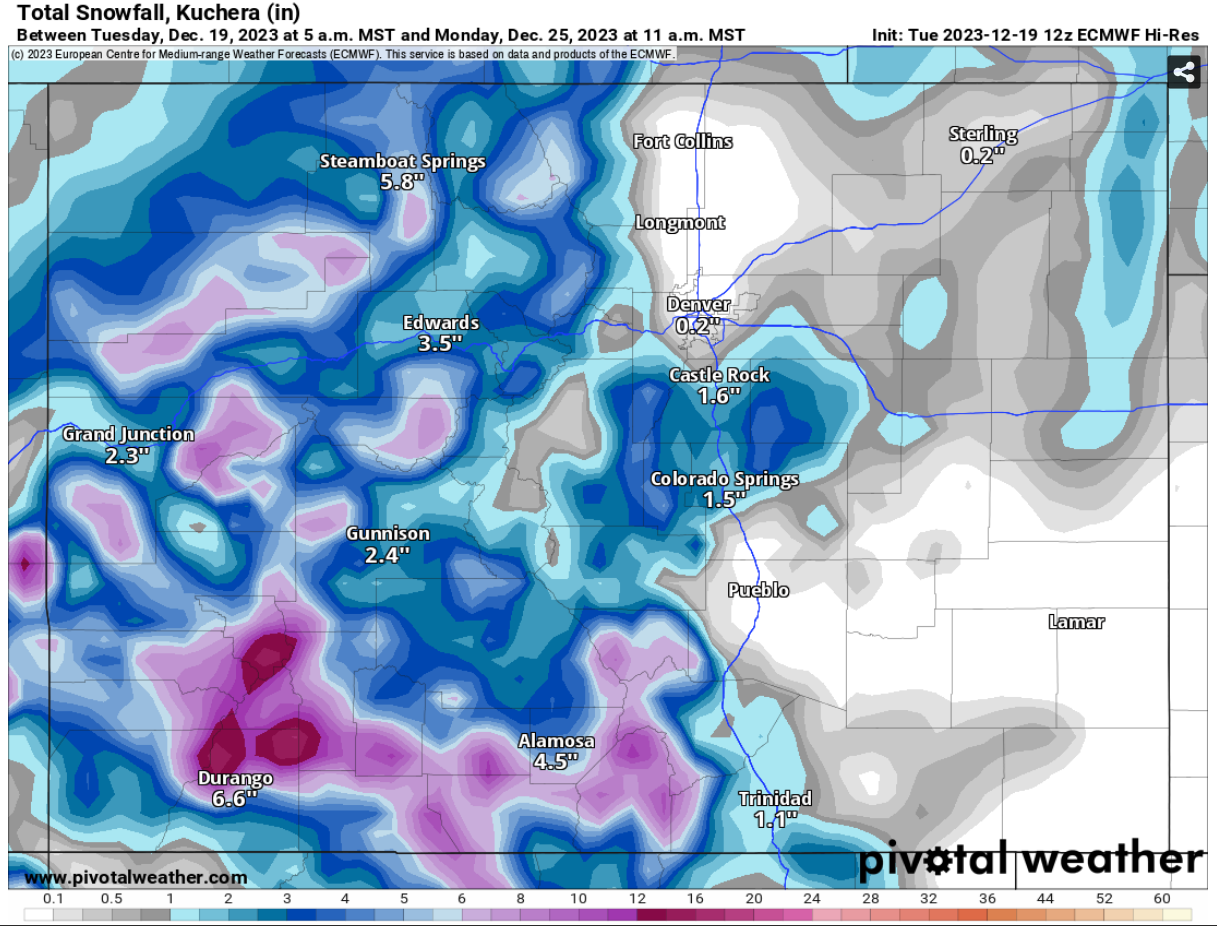
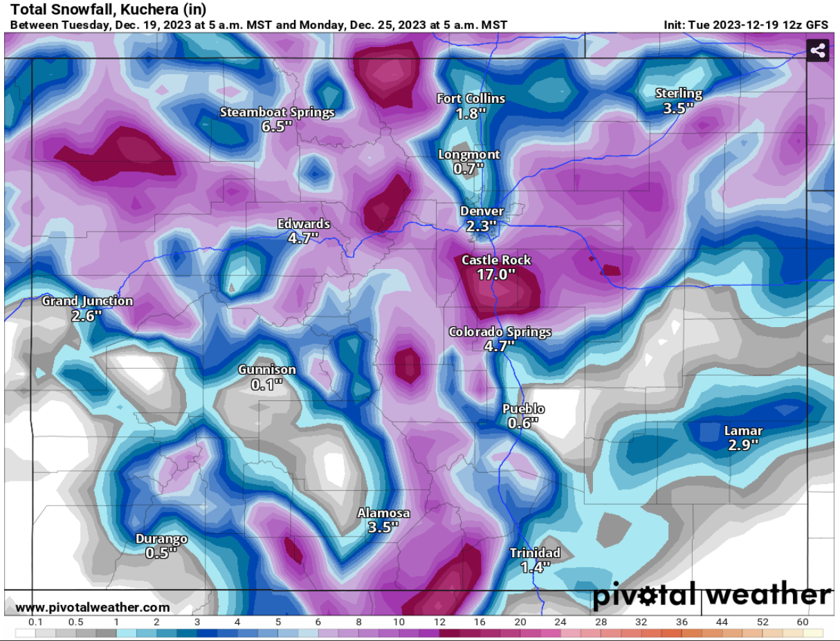
Despite the intricate web of possibilities, the model solutions for our region showcase a broad range. While not yet a certainty, there’s an increased probability of measurable snow over an inch ending in the evening on Christmas Day (some models like the NWS Blend, depict the 26th as the end of the event). A subset of scenarios predicts mostly dry conditions in the Denver Metro Area, while others suggest the potential for a significant snow event with upwards of 17″ of snow in parts of the state [Fig.3]. As for the actual snowfall totals, only time will tell.
 |  |  |
Stay tuned for updates as we continue to track the storm’s development in the coming days. For more information on how you can get personalized forecasts from Skyview Weather, contact us at [email protected].