Introduction
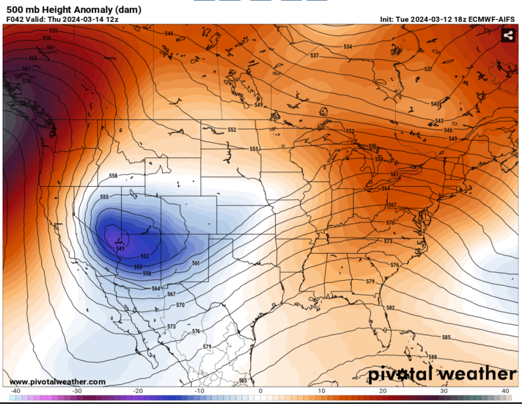
Denver, Colorado, renowned for its stunning Rocky Mountain vistas and mercurial weather patterns, is on high alert as a potentially historic winter storm threatens to engulf the region from tomorrow through Friday. With the National Weather Service (NWS) issuing a Winter Storm Warning for much of the Front Range Urban Corridor, residents are bracing themselves for what could be a record-breaking event [Fig. 1].
Timing
The storm is poised to make its presence felt starting Wednesday, March 13th, and may linger until Friday, March 15th. What begins as mild and dry conditions on Wednesday will rapidly deteriorate as a potent cold front sweeps in, ushering in heavy snowfall and significantly cooler temperatures.
Impacts and Expectations
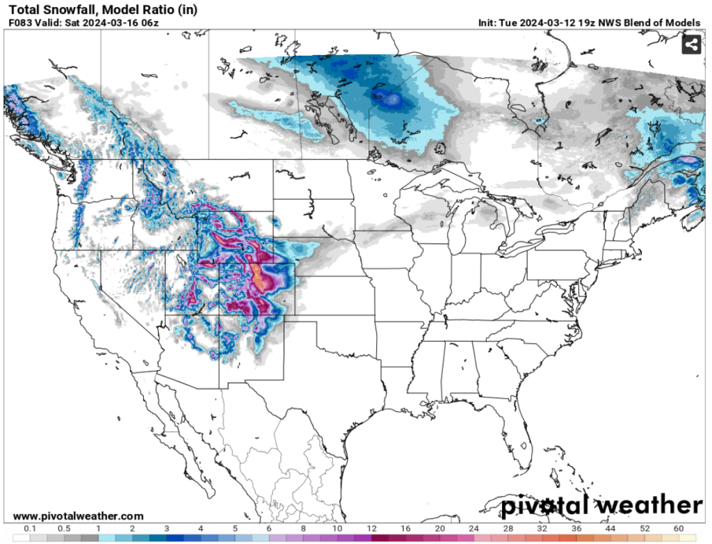
This impending storm isn’t one to be taken lightly, with snowfall rates anticipated to range from 0.5 to 1.0 inches per hour and gusty winds reaching speeds of up to 35 mph. The resulting snow accumulation could be substantial, particularly in the foothills and Palmer Divide regions. In the foothills, several feet of snow may accumulate, rendering travel virtually impossible and posing significant challenges to emergency response efforts.
Along the I-25 corridor and Palmer Divide, residents should prepare for widespread moderate to heavy snowfall, potentially totaling over a foot in accumulation. Travel conditions are expected to deteriorate rapidly, especially west of I-25 in the Denver metro area, where amounts could exceed 2 feet due to drifting snow [Fig. 2].
Even the eastern plains won’t escape the storm’s grasp, as rain transitions to snow on Thursday. While there’s some uncertainty regarding snowfall accumulations for areas east of Denver, the potential for road closures and hazardous travel conditions remains significant.
Fire Danger in Texas
While Colorado braces for snow, Texas faces a different threat altogether. A quick-moving mid-level wave is set to traverse eastward through southern Kansas, bringing warm and dry conditions to Texas on Wednesday. With high temperatures soaring into the 70s and even nearing 80 degrees across some areas, coupled with low relative humidity values in the 10-15% range, fire weather concerns are elevated, inducing a Red Flag Warning for the area. Residents are urged to exercise caution and adhere to all fire safety and prevention measures to mitigate the threat.
Preparation and Safety
Given the severity of the impending storm, preparation and safety should be top priorities for all residents. Stocking up on essential supplies, avoiding unnecessary travel, and staying updated on weather advisories are crucial steps to take.
Additionally, it’s essential to winterize vehicles and check on vulnerable neighbors to ensure their well-being throughout the storm. By taking these precautions, we can mitigate the storm’s impact and safeguard our community’s safety and resilience.