Areas within the Great Plains (including eastern Colorado) are on high alert as severe weather continues to grip the region into tomorrow, with the potential for widespread storms and even tornado activity. Today marked an active day for Colorado with numerous thunderstorms, some of which were deemed severe by the National Weather Service (NWS). Tomorrow, the situation is expected to escalate further, with more intense storms anticipated, particularly to the east.
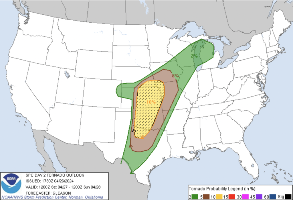
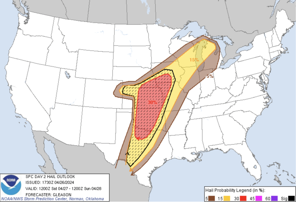
The entire state is under a general thunderstorm outlook, while the far eastern section faces a slight chance of severe thunderstorms, indicating a level 2 out of 5 risk factor [Fig. 1]. A 2% chance of tornadoes is expected in far eastern Colorado [Fig. 2], coupled with a 15% chance of strong hail [Fig. 3].
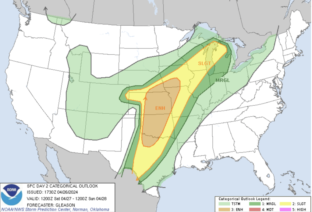
The forecast paints a concerning picture for the region. A shortwave trough over the Upper Midwest, gradually moving across the Great Lakes, is expected to interact with a large-scale upper trough over the Southwest. This convergence will propel the system across the southern and central Plains, accompanied by a potent southwesterly mid-level jet.
Lee cyclogenesis is forecasted over western Kansas, leading to the development of a dryline extending southward and a warm front stretching northeastward. These weather dynamics create an environment ripe for severe weather outbreaks. As the system progresses, it is expected to bring substantial destabilization along and east of the dryline, fueling thunderstorm development.
The atmospheric conditions are conducive to the formation of supercells capable of producing large hail exceeding 2 inches in diameter. Moreover, the setup presents a heightened risk of tornadoes, with the potential for multiple strong tornadoes during the late afternoon to early evening hours in parts of Kansas, Oklahoma, and Missouri.
Additionally, Colorado is bracing for a separate weather event—snow. Yes…everybody sigh together. As a low-pressure system moves northeast across southern Colorado, upslope flow will intensify, leading to moderate to heavy precipitation, especially in areas lee of the Front Range mountains. However, temperatures will be a large factor in determining the type of precipitation (rain or snow or mix) and how much accumulation if any, the urban corridor will receive.
As the storm progresses, drier downslope flow will gradually replace the upslope flow, bringing an end to the precipitation event. However, the aftermath of the storm is likely to leave a considerable impact, with large snow accumulations in higher elevated areas and the possibility of minor flooding in low-lying areas due to convective elements.